Van: The Capital of the Urartians and a Deep Blue Sea
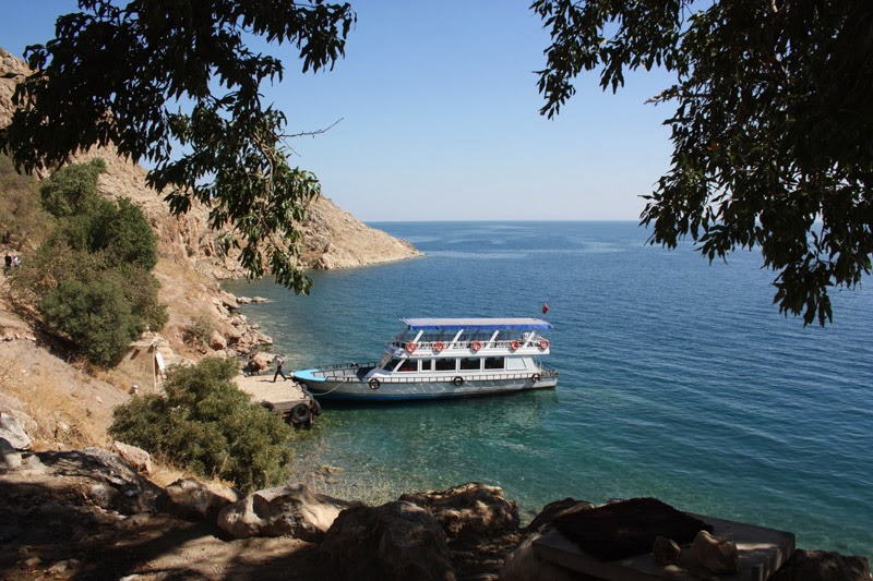
Once upon a time, the chief monk living on this island had a daughter named Tamara, whose beauty was legendary. A young shepherd from the village across fell in love with her and swam to the island every night. Tamara would light a lantern to guide him in the darkness. When her father learned of this, on a stormy night he took the lantern and moved it around, misleading the young man. Exhausted, the shepherd shouted “Ah Tamara!” with his last breath before drowning. Hearing this, Tamara threw herself into the lake. From that day on, the island has been called “Ah Tamara,” which over time became “Akdamar.” This touching story has become legendary through the narration of the Armenian poet Hovhannes Tumanyan.
Muradiye Waterfall and the Transition to Doğubeyazıt
Mount Ararat: An Unforgettable Camp at the Summit of Legends
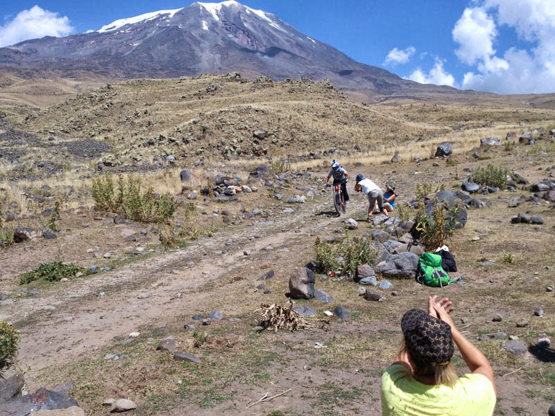
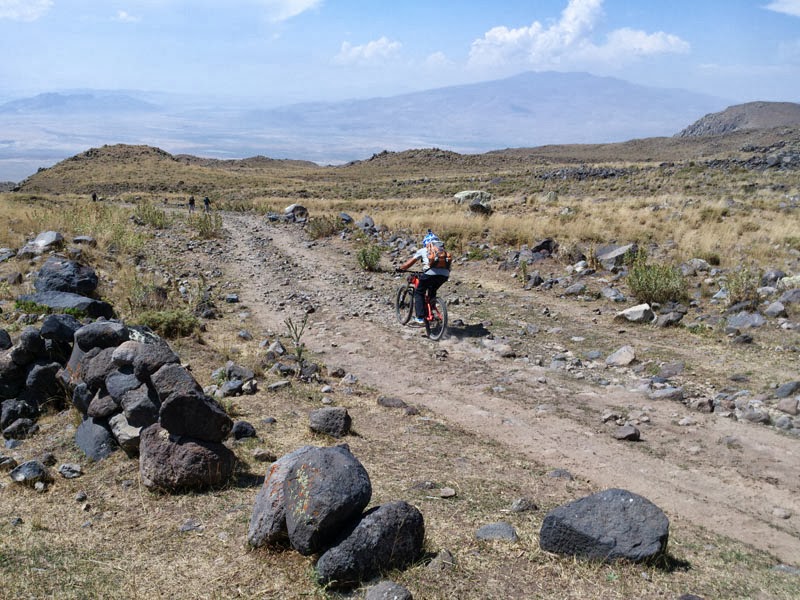
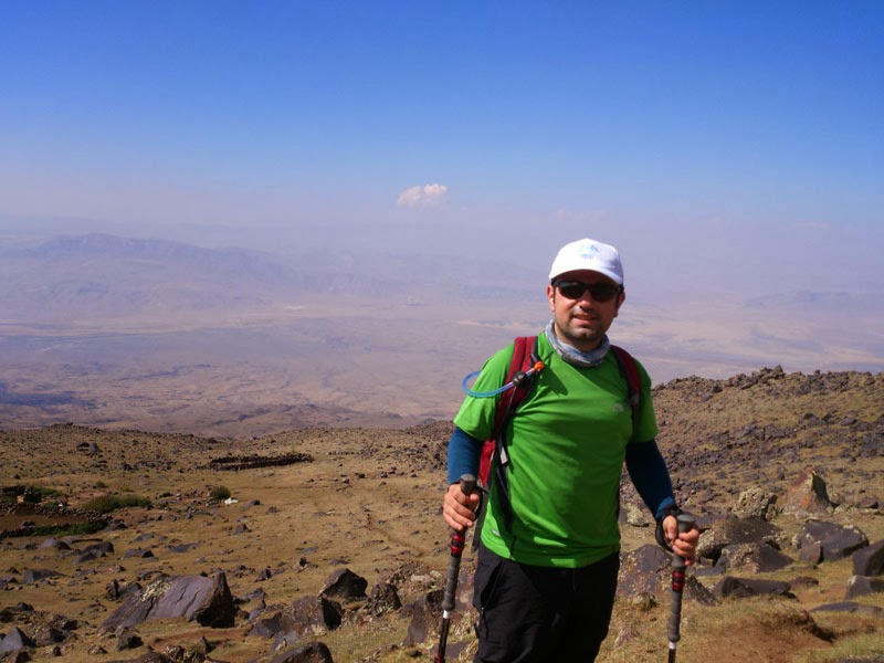
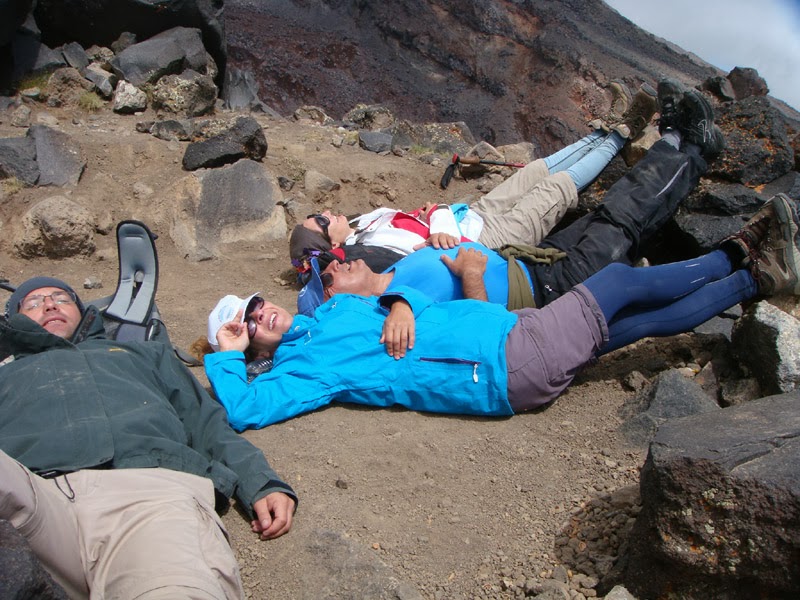
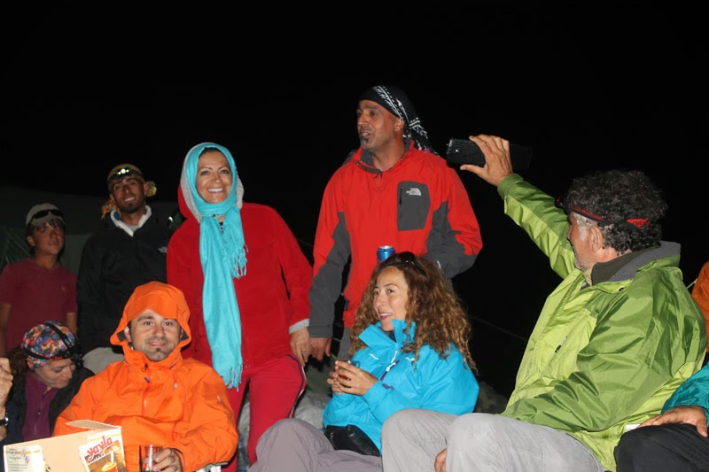
After dinner came chat, songs, and folk tunes. Mehmet Ceven sang melodies from Dengbej culture with his beautiful voice. That night I learned the lively and memorable “Şemmame” from the Hakkari region.
You can see how to dance the Şemmame halay here.
Esen Hoca is a history teacher… He told us about the Janissary revolts during the periods of Selim III and Mahmud II, and the new army organization that was intended to be established. His examples were engaging. For instance, while explaining the Redif armies, connecting it to the Yemen Türküsü and singing the folk song with us was wonderful. The Redif armies were units made up of demobilized reserve soldiers. When there was a rebellion, the Ottomans would send this army to Yemen. Many families never heard from their children sent to faraway Yemen again. Even those who survived the war often could not return and lived out their lives there.
There is no cloud in the air, What is that smoke? / Havada bulut yok bu ne dumandır
There is no death in the neighborhood, What is that cry? / Mahlede ölüm yok bu ne figandır
How thorny is this land of Yemen! / Şu Yemen elleri ne de yamandır
Over there is Yemen, its rose is Fenugreek / Ah o yemendir gülü çemendir
Those who go never return, Why? / Giden gelmiyor acep nedendir
This is Housh, its roads are steep / Burası Huş’tur yolu yokuştur
Those who go never return, What’s going on? / Giden gelmiyor acep ne iştir
There is a repeated voice in front of the barracks, / Kışlanın önünde redif sesi var
Look in his bag I wonder what he has, / Bakın çantasında acep nesi var
A pair of shoes and a fez! / Bir çift kundurayla bir de fesi var
Over there is Yemen, its rose is Fenugreek / Ah o yemendir gülü çemendir
Those who go never return, Why? / Giden gelmiyor acep nedendir
This is Housh, its roads are steep / Burası Huş’tur yolu yokuştur
Those who go never return, What’s going on? / Giden gelmiyor acep ne iştir
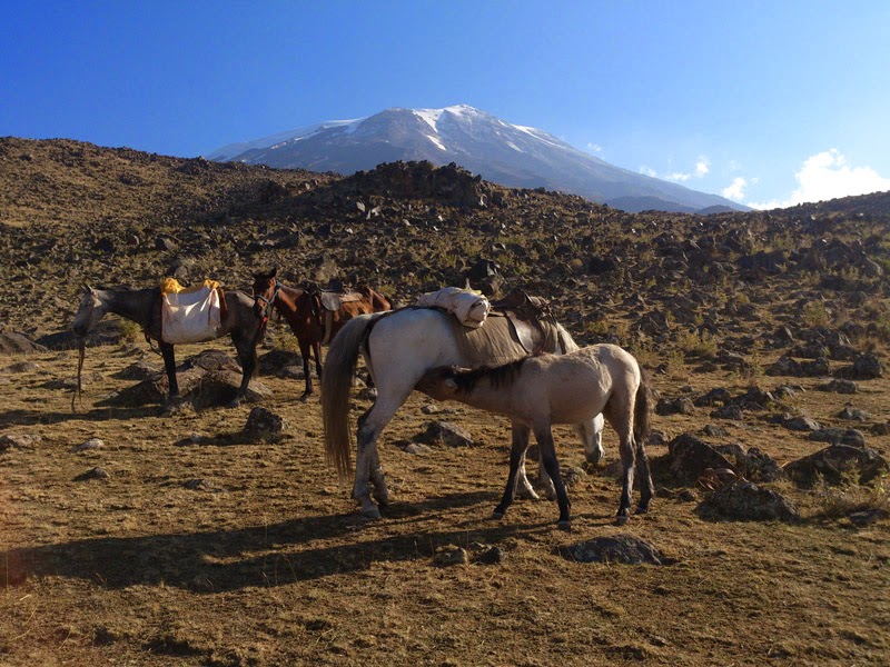
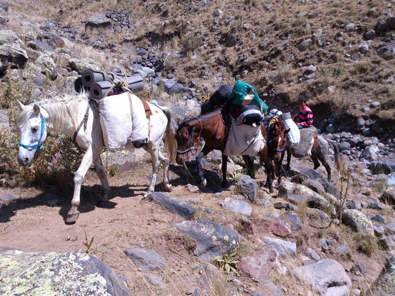
The horses also start the day with breakfast.
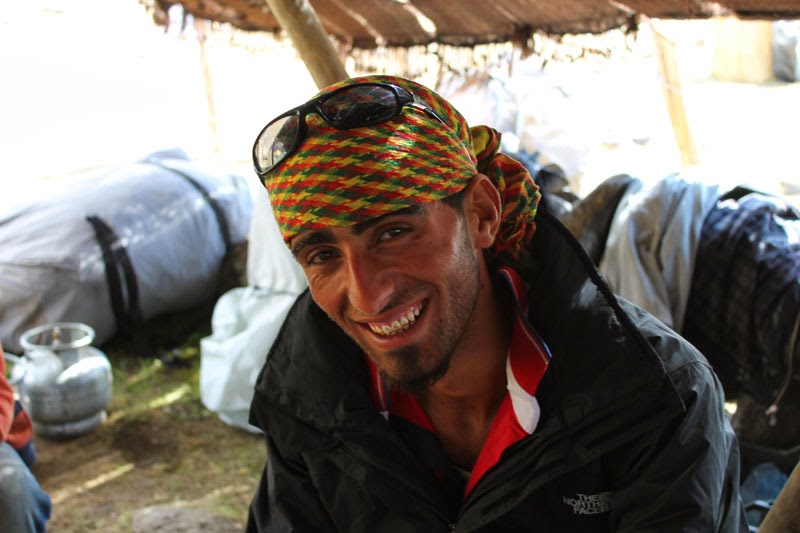
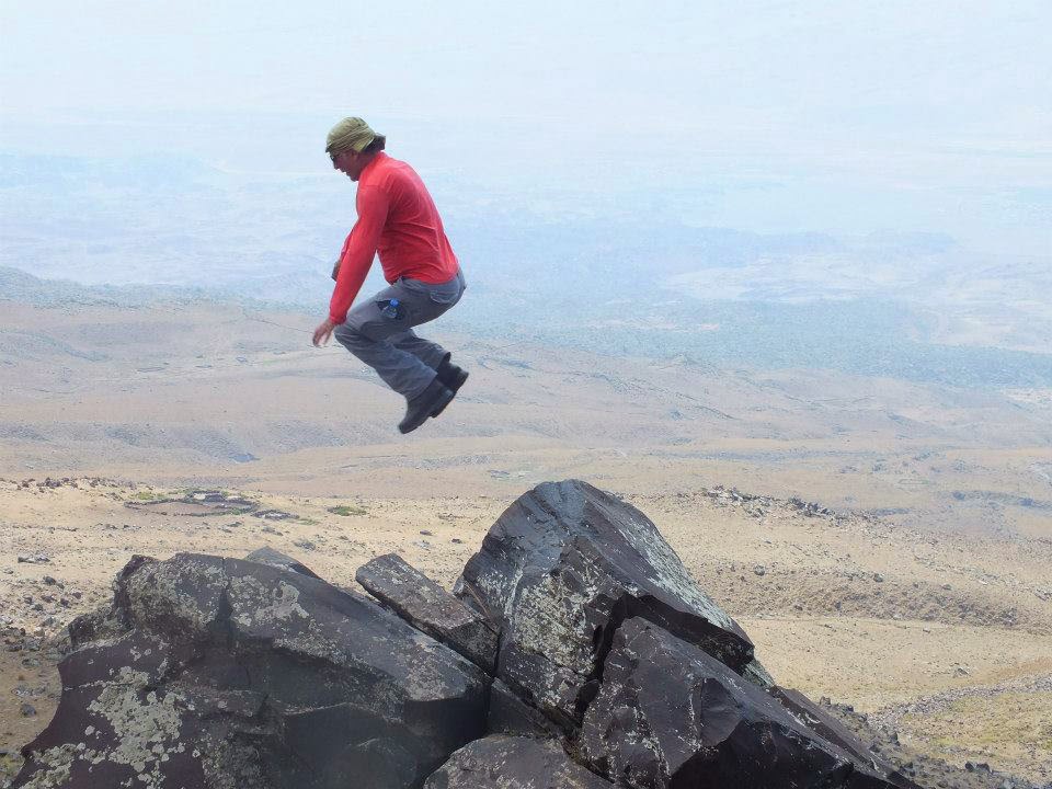
He loves rock climbing and mountains. He was as cheerful as a child on Mount Ararat. “He stayed in the air, I have a witness!” 🙂
Architectural Treasures of Doğubeyazıt and Iğdır
Kars: The Modern City of the East with Russian Influences
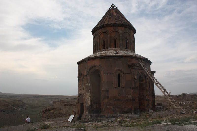
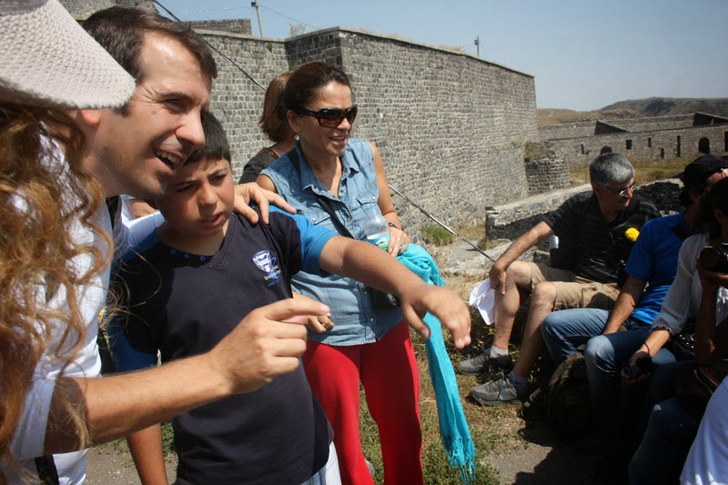
On the left, Esen Hoca, looking like a small dot, is lost in thought watching the Arpaçay Canyon. While wandering among these silent witnesses of history, your heart fills with both melancholy and admiration.
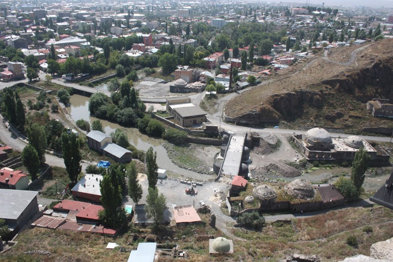
On the right, the baths built in the 1700s looked more solid and aesthetic than the modern buildings around them. The stone bridge and baths were under restoration.
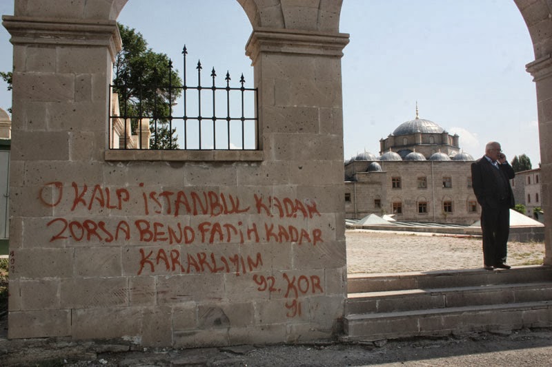
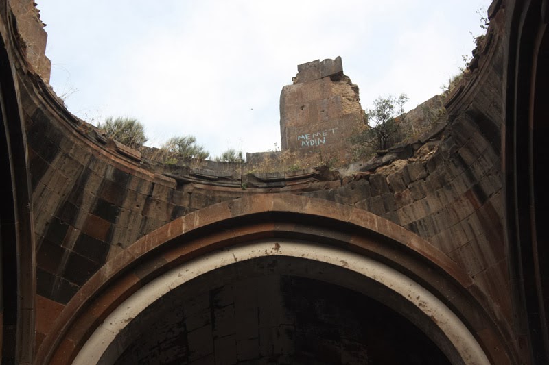
One of the scribbles I frequently saw on historical monuments in the Ani Ruins as well. They wrote it on the mosque wall. Education is essential.
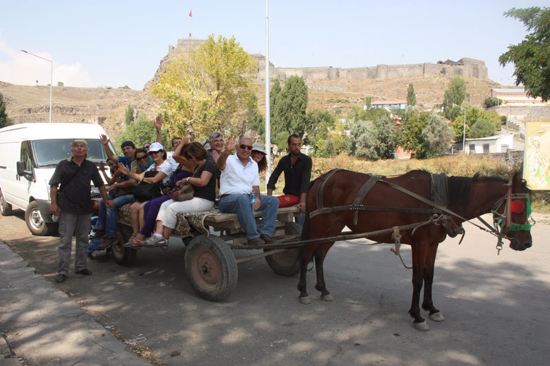
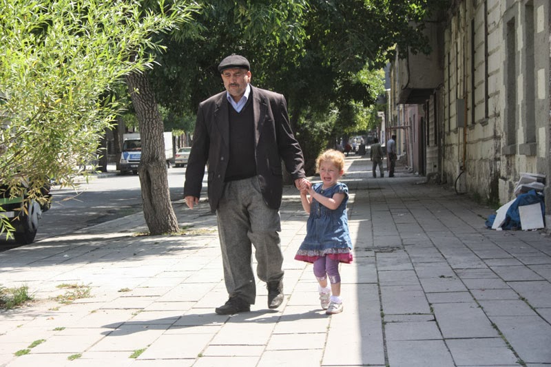
They call the horse carriage “gaçka” (kaşka?) here. İlhan Abi, standing in the photo, was thoughtful. It became an interesting and beautiful memory for us.
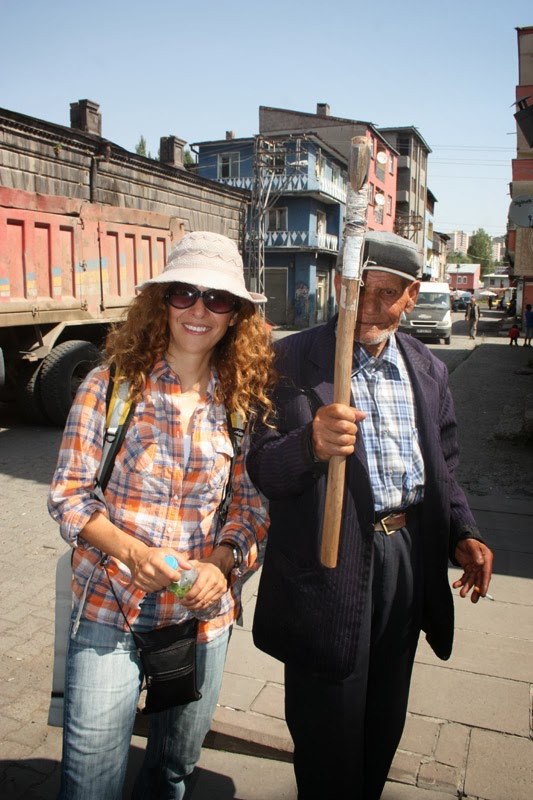
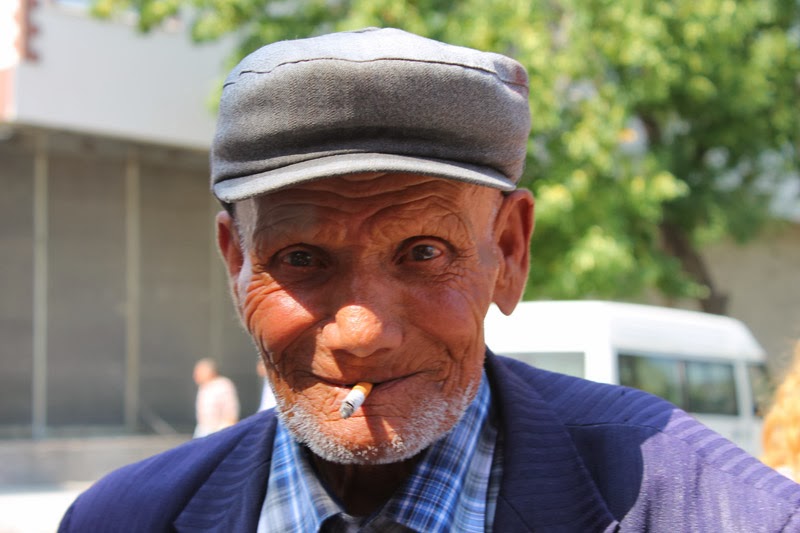
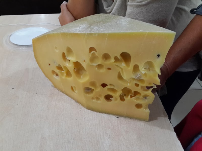
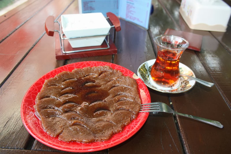
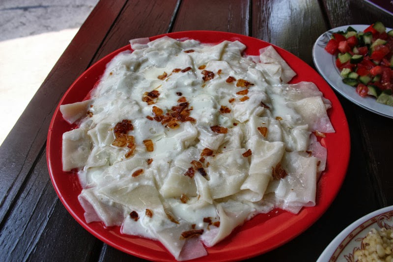
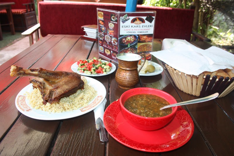
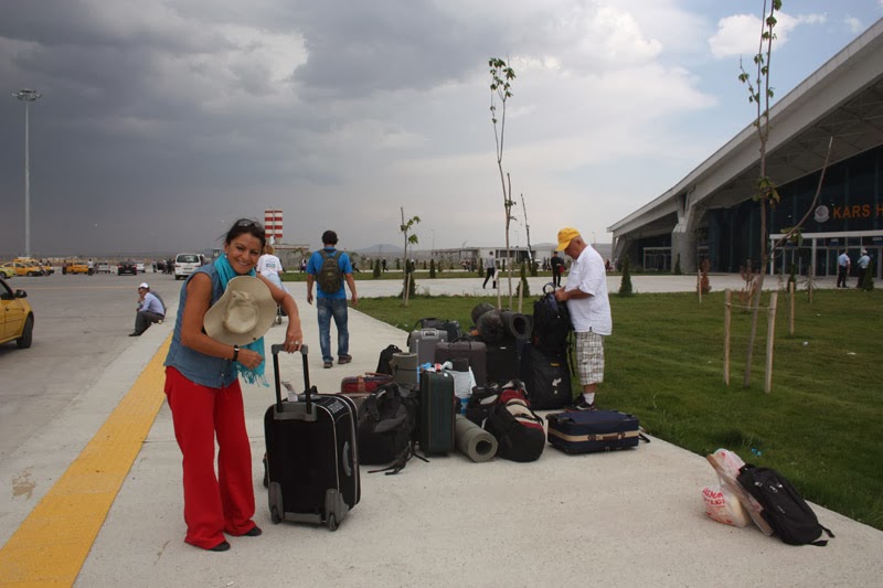
Kars Airport is only 7 km from the city center. Transportation is easy, and the return was smooth. We reached the end of another trip — but once Eastern Anatolia enters your heart, it doesn’t let go easily.
Dear H’acer, as Ahmet Ercan Hoca calls her. H’acer kept our teacher company throughout the trip. But she has aged a bit now. When she started to miss her old days, a new one came along and she is staying at home. Since H’acer is very sensitive, she still doesn’t know about this new companion 🙂
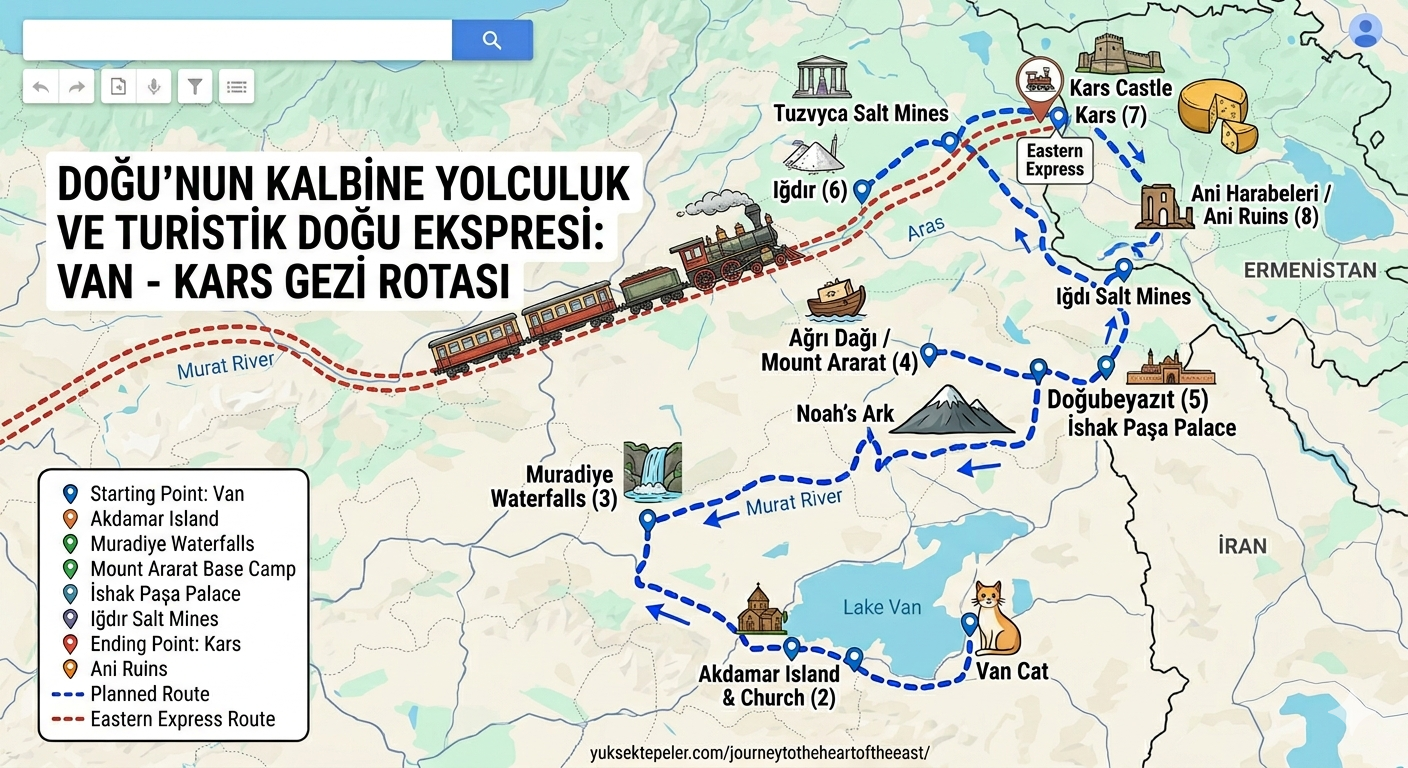
A New Generation Fairy Tale: The Touristic Eastern Express Experience
Since I first penned this article in 2013, the most significant development to revolutionize tourism in the region is undoubtedly the \
24 Hours on the Rails: Departing from Ankara, the train glides through Kırıkkale, Kayseri, Sivas, Erzincan, and Erzurum before reaching Kars. Passing through snowy mountains, deep valleys, and frozen rivers feels just like living inside a movie frame.
Wagon Culture: Passengers decorating their cabin windows, ordering cağ kebab to the stations when the train stops, and the friendships formed with neighboring wagons have turned this journey into a “socialization ritual” rather than just a trip.
If you are planning to take this route in winter, don’t forget that tickets sell out months in advance and you must bring an “interrail spirit” with you!
Anatolia is such a unique country with its nature and culture (özgen) that it is a peninsula where countless traces of civilizations, piled upon one another from the depths of the past and growing ever larger, have been carried to the present day — a land stretching like a horse’s head from east to west. To be an Anatolian and to be born in Anatolia is a great privilege. When the great Atatürk founded the Republic, he also said: “We Turks are not only those who came in 1071; we are the unique heirs of the civilizations that have lived in this country for at least ten thousand years.”
That is why, during our Northeast Anatolia trip, we needed to first look at the places we visited and ask: Who lived here? How did they live? What kind of remnants did they leave behind? We had to examine them by consulting the sources.
On Sunday, August 25, 2013, I met my friends at Yıldız Park at 09:00 as if for a farewell breakfast. We started the day singing songs and laughing together. We hugged and parted. We flew from Istanbul to Van with THY at 14:00 in 1 hour and 45 minutes. On the plane, I spent the time talking with Mustafa Esen Hoca, the valuable historian and trip leader on behalf of YUDOSK, about the past, civilization, understanding, behavior, and politics. His serious, instructive, and upright personality gave the sign that the trip would go well.
While writing these lines, my peer and fellow townsman Prof. Dr. Celal Batur, who teaches in the USA, sent me a message. Yesterday I was still a child with him; now they have started calling us uncle and grandfather. He too has been affected by this situation — look at what he says:
Hey Time
Listen carefully
You’ve been struggling with me since I was born
You passed quickly when you should have slowed down
You almost chose to stop when you should have sped up
Now on this dead-end descent at the end of the road
At least don’t push from behind!
We’re going anyway!!!
That is why, whenever I find the opportunity, I travel a lot. The Serbs say, “Live as if today is your last day,” while the Japanese say, “There is no tomorrow, only today.”
During our Northeast Anatolia trip, let us look at the places we visited and ask: Who lived here? How did they live? What kind of remnants did they leave behind? Northeast Anatolia is also known as Southern Caucasia. Its other English name is Transcaucasia.
The first civilization that lived in this region is the one called “Karaz,” probably associated with Turanian peoples, followed by the “Caucasian” Urartians. Then came the Hatti and the Hittites.
The Land and Civilization of Karaz. The scope of our trip in Anatolia covers the Southern Caucasus or Northeast Anatolia region, which includes the ancient Anatolian civilizations of Karaz and the Urartian civilization within it. This region is the land where the Karaz culture was seen around 3000 BC. This country extends from the southern Caspian Sea to the south of Lake Van. Today, traces of this culture can be seen in Kars, Ardahan, Artvin, Bayburt, Gümüşhane, Erzurum, Bingöl, Iğdır, Ağrı, Van, Tunceli, and Malatya-Elazığ. According to the information obtained, the Karaz culture encompassed Eastern Anatolia, Transcaucasia, Azerbaijan, and Northwest Iran throughout the Late Stone Age and the Bronze Age. Soviet archaeologist Boris Kuftin first defined this culture in 1940 and named it the Kura-Araxes culture. The spread area of the Karaz culture extends in the north to the North Black Sea Mountains – Transcaucasia line, in the east to Lake Urmia in Iran, in the west to Divriği – Kangal and Malatya – Elazığ, and in the south to Kahramanmaraş – Amik Plain and Palestine. Today, Georgia, Armenia, Azerbaijan, Northeast Anatolia, and Northwest Iran constitute the land of Karaz.
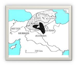
The core spread areas where the Karaz and Urartian civilizations originated.
Some archaeologists argue that the origin of Karaz is Georgia. It was first defined with pottery finds from Karaz Höyük near Erzurum, and therefore named the Karaz culture. According to Turkish archaeologists, the oldest settlements of the culture are in Eastern Anatolia, around Erzurum. In this region, Karaz Höyük, Pulur Höyük, Güzelova Höyük, Sos Höyük, and Büyüktepe Höyük are the first Karaz settlements.
In Turkey, the Karaz culture is also known by other names in different countries: Early Transcaucasian culture, Yanık culture, Hirbet Kerak culture, Copper Age of Eastern Anatolia, Bet Yerah, and Eneolithic culture of Transcaucasia.
It is suggested that the pottery tradition that emerged at Arslantepe Höyük is related to Caucasian communities that destroyed and settled the city. The fact that the final layers of the Chalcolithic period at Tepecik / Makaraz Höyük yielded finds of both Karaz, Uruk, and Central Anatolian pottery strengthens the claim that the Karaz culture originated in this region. However, the oldest excavation where the characteristic pottery of this culture was found is Karaz Höyük. Foreign names do not contain as much evidence.
It is accepted that the origin of the Karaz culture is Hurrian and that it is one of the largest cultures of the Near Eastern prehistory.
The two distinctive and defining features of the Karaz culture are its pottery and its architecture. This culture, seen in Northeast Anatolia in the Late Stone Age and the beginning of the Early Bronze Age, spread to surrounding regions in later periods. This culture reached Northern Syria and Palestine in the Early Bronze Age – Middle Bronze Age. The two main routes of spread were via Lake Urmia to Northern Mesopotamia and via Elazığ – Malatya to Northern Syria and Palestine. Karaz pottery began to appear in Eastern Anatolia in the Late Stone Age, but it reached its fully developed form in the Early Bronze Age. The Early Bronze Age is identified with the Karaz culture.
While the potter’s wheel was known in contemporary settlements, Karaz pottery is handmade. Karaz pottery is monochrome, slipped, and also burnished. Decorations consist of lines. These lines are usually spiral, parallel, or intersecting. Groove, channel, and relief examples were applied. Karaz ceramics are often “dark-faced burnished ware.” Burnishing is a common feature seen wherever Karaz pottery spread.
Karaz houses are rectangular, one- or two-roomed structures with stone foundations and mud-brick walls. There are also hearths used in rituals. This architectural form continues in Anatolian houses today. The wheeled structures in other regions where the culture spread belong to the Hurrian tradition.
Karaz finds are extensively exhibited in the Kars and Erzurum museums. Don’t miss them.
According to Sumerologist Muazzez İlmiye Çığ, the Karaz people were a Turkish-origin civilization.
The Land and Civilization of Urartu. Today, the borders of the Urartian country center on Van and include the surroundings of Lake Van, Kars, Ardahan, Ağrı, Iğdır, Bitlis, and the Hakkari region. Its name in Urartian was Biainili, and its capital was Tuşpa (Van). At its strongest period in the 8th and 7th centuries BC, the Urartian State encompassed today’s Northeast Anatolia, Northwest Iran, a small part of Iraq, and the Aras Basin in the north. The borders of the wide Urartian settlement area were formed by the Karasu-Euphrates in the west, the North Armenian Mountains in the north, the Savalan Mountains in Iranian Azerbaijan in the east, and the Eastern Taurus Mountains joined with the Zagros Mountains in the south. Mount Ararat is in the middle of this mountainous region. Due to its fame in the Bible, this mountain was named “Ararat” because the name Urartu was written with the consonants “R R T.” In short, Ararat is another pronunciation of Urartu.
With its height of 5,165 meters, Greater Mount Ararat is the highest mountain in the south of the Caucasus. Lesser Mount Ararat, Tendürek, Aladağ, Süphan Mountain, and Nemrut Mountain, most of which exceed 3,000 meters, are generally located near Lake Van.
According to the Torah and Assyrian inscriptions, between the 13th and 9th centuries BC, the Uruatri (Urartu) and Nairi societies lived in Eastern Anatolia in the form of principalities and tribes. In the 13th century BC, the Urartians did not consist of a single state but of different tribes. In the Iron Age, wars intensified. With the entry of Assyrian King Shalmaneser III into Urartian lands, the tribes united under Sarduri I on the shores of Lake Van in Tuşpa in 844 BC, and the Kingdom of Urartu emerged. The first Urartian inscription and the first monumental structure in Van Castle belong to this king. The kingdom weakened after Rusa II, one of the strongest kings of the 7th century BC. The Scythian and Median invasions in the 7th century BC wore down Urartu. After 612 BC, the Urartians could not show any influence, and in 590 BC they were destroyed by the Medes coming from Iran. From the end of the 6th century, the name of the region appears as Armina instead of Urartu in Achaemenid sources. I do not know whether Armina could be today’s Armenian.
The Assyrian and Urartian seals are almost identical.
There is no connection between the language used by the Urartians and the Indo-European language family (Armenian, Zaza, Persian in Anatolia) or the Semitic language family (Aramaic, Arabic). The language spoken by the Urartians is related to a branch of Hurrian and shows great similarity, most closely resembling the Northeast Caucasian language family (Chechen). Among living languages, the most common words are between Urartian and Northeast Caucasian languages; out of a total of 350 known Urartian word roots, 169 are still in use today.
The Urartians used cuneiform and Hittite hieroglyphic writing. In international correspondence, they frequently used the Assyrian language. The Urartian inscriptions were deciphered by the German philologist Johannes Friedrich.
The Urartians believed in, sanctified, and sacrificed to 79 gods, goddesses, and divine beings at certain periods (just like the Shamans). The first three in rank are Haldi, Teişeba, and Şivini. Haldi was the chief god of the Urartians. Teişeba (Storm God) is of Hurrian origin and is called Teşup among the Hittites. Şivini is the Sun God and is also of Hurrian origin. It corresponds to Şimegi among the Hittites. In large settlements, the Urartians built tower-like temples for their gods and sacred niches resembling doors carved into rocks.
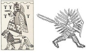
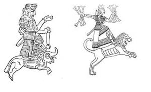
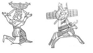
Sacrifices could be sheep, cows, or cattle. Just like today’s Islamic practice.
In Van Castle, channels can be seen arranged to drain the blood of the sacrificed animals. Some sacrifices could even be children.
The Urartians cremated the dead and buried their ashes in the ground with their belongings (in urns), while the ashes of kings were placed in caves (üngür). Ordinary people’s ashes were kept in pots (as is done today in Russia and the USA). The Urartians believed in life after death, just like today’s monotheistic religions.
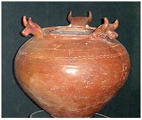
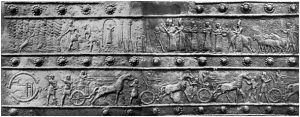
The Armenians may possibly be descendants of the Nairi people.
In the Urartian Kingdom, practices such as cuneiform writing, making war annually, measurement systems, royal titles, erecting steles, war methods, decoration, and relief craftsmanship developed under Assyrian influence. Architecture, crested helmets, siren attachments on cauldrons, hieroglyphic writing, cremation, and ivory craftsmanship were influenced by Northern Syria. On bronze plaques, Assyrian influence can be seen alongside Late Hittite traces. The Urartians created their own civilization by drawing inspiration from surrounding civilizations, just as the Ottomans and Seljuks did.
Most of the Urartian remains are exhibited today in the Museum of Anatolian Civilizations in Ankara.
Come, let us travel together in the changing conditions of today through the lands where these civilizations spread.
Van (Tuşpa) – The Capital of Urartu
Prof. Dr. Övgün Ahmet ERCAN
[email protected]
www.ahmetercan.net
Our first stop by plane was Van. When Van is mentioned, one thinks of the 2011 M=7.2 Van earthquake, the Van cat with different-colored eyes and white fur, Lake Van, the Urartian civilization, and Akdamar Island. Van’s name in the Urartian period was Tuşpa. After the 2011 earthquake, I had come to examine the Medical Park facilities and also in 2013 to give a speech at a meeting of the Ministry of Environment and Urbanization.
Van is located in Turkey’s Eastern Anatolia Region, on the shores of Lake Van, which is the largest closed basin in Anatolia surrounded by mountains. Its lands are fertile but uncultivated, its rivers are abundant but it lacks greenery, and its climatic conditions are quite favorable for settlement. Van is a junction point with air, sea, railway, and road connections on the transportation route to Iran. There is a train to Damascus and Tabriz once a week.
The people of Van call Lake Van the “Van Sea.” The airport is right on its shore. The airport is not large enough to handle the load of Van and its surroundings, but expansion work has begun.
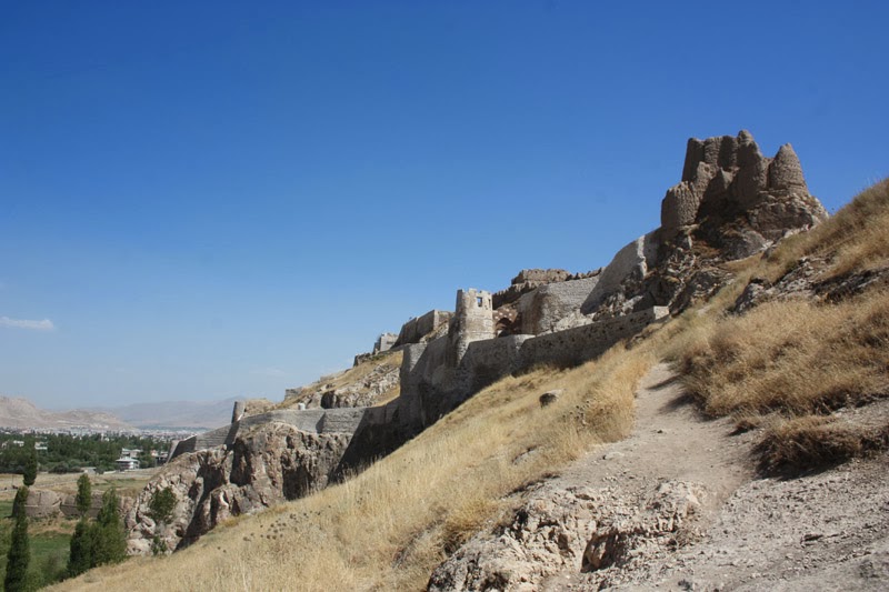
Van Castle is built on a peninsula extending into Lake Van. The old city of Van was established in the solid area surrounded by walls on the southern part of the castle until World War I. The city of Van, which migrated with the Republic to today’s earthquake-prone area, suffered the most destruction in the 2011 earthquake. The population of Van, which was 31,500 in 1965, is now around 375,000. There is almost no production in the city, but there are many newly built structures and a luxurious lifestyle. Why? From where? It is hard to comprehend.
The remains of the old city on the castle have survived to the present day. There are also some remains related to the walls. The only intact gate is the Middle Gate facing south. All the hills surrounding Lake Van are steppe, like a desert, with no dwarf plants, bushes, grass, or trees. It is a completely bare country. The shores of Lake Van, however, are generally green with poplar trees, like an oasis. However, because the new main road was built by filling in the shore of Lake Van, the beach where people could swim in Van has been destroyed. In addition, the houses and accommodations on the lake shore are under road noise all evening.
The mountain behind Van Castle is Mount Erek; to the northwest, in Bitlis territory, stands the huge Mount Süphan (4,058 m).
Just north of Van, two stepped flat faults pass under the city of Van and extend toward the lake by forming a valley to the east of the castle. The other four faults run east-west and also pass under Van. In short, the ground beneath the new city of Van is a battlefield of faults. This city should be moved from here; otherwise, it will continue to be a battlefield of earthquakes in the future.
The temporary housing built after the 2011 earthquake is still standing on the lake side of the Edremit road — I don’t know if it is still in use. However, multi-story TOKİ housing has been built in Van and on the hills of Edremit for those affected by the earthquake. The location selection is appropriate.
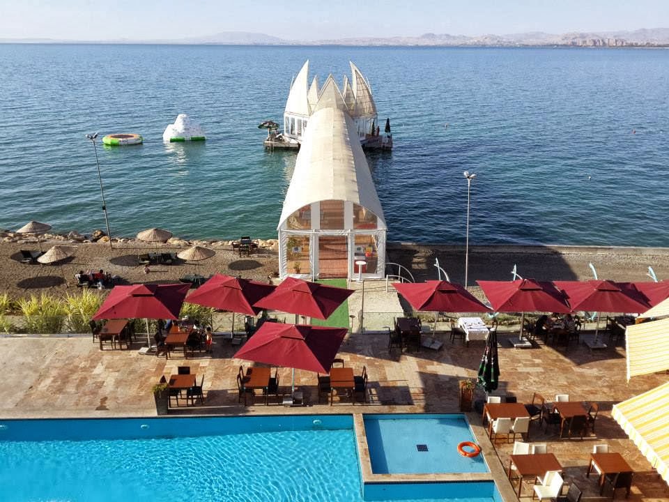
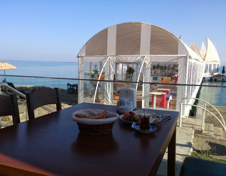
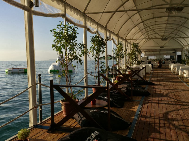
We ate our meal at a restaurant on the lake shore. The head waiter, a handsome young man named Fahri Yaşar, about 35 years old, had migrated to Van from Hakkari for security reasons.
“In Hakkari, there was conflict every day after sunset. Since the Syria events, business at this hotel has been slow. No one comes or goes. Before the Syria events, we hosted 200-300 people a day. Now only 4 or 5.”
“Well, if the Prime Minister hadn’t gotten involved, it wouldn’t have been like this. There are no local or foreign travelers anywhere in the country.”
“We are nine siblings, but we are making a living.”
The grilled meat we ate was delicious, as was the ayran aşı soup before it.
Merit Şahmaran Hotel is a 4-star hotel on the Van-Edremit road, on the shore of Lake Van. It is quite clean and has an extraordinary lake view. However, the loud music from the empty disco that continues until 1-2 at night and the noise from the Erciş road prevent sleep.
As soon as we settled into our accommodation, we entered Lake Van to swim. The water is moss green. Because it is very carbonated, it is slippery; it feels like swimming in thick water. The water is cold, but you get used to it once you enter. The lake is as flat as a plate, completely wave-free. A motorboat departed from the Edremit direction and created a slight ripple. The pearl mullets living in Lake Van make small waves by jumping and flashing. I like that fish live here. Not many people enter the lake, but those who come from outside Van, like us, do. The lake water is slightly bitter and salty. We chatted with three enlightened young people of Turkmen origin from Van.
During the late dinner, the famous soup of the Van region — ayran aşı — and the grilled meat, along with the loud music, prevented me from sleeping.
At 05:55, the back of the mountain behind Van was illuminated in bronze color, and a new day dawned. Lake Van shimmered silver but remained wave-free. There are no trees around, so there is no birdsong.
Civilization. Van’s roots go back to the Urartians. The Urartians are more related to Persian culture; they took cuneiform writing from Mesopotamia and are a civilization that may have ethnic ties with the Armenians. The capital of the Urartians, Van, was called Tuşpa. Van’s history dates back to 7000 BC. In excavations at Tilki Tepe, 6 km south of Van Castle, and at Ernis burials north of Lake Van, finds related to the Chalcolithic, Bronze, and Iron Ages were encountered.
The first founder of the city was the Assyrian Queen Semiramis. The Hurrians first settled in this region, and during the Urartian period the city became the center of a principality. After the Urartians, the Medes, Persians, Alexander the Great, Seleucids, Armenians, Parthians, Romans, Sasanians, and Eastern Romans ruled the city. In 675 AD, Muslim Arabs captured the city; later, the Eastern Romans again, then the Seljuks who defeated them, followed by the Ilkhanids, Jalayirids, Karakoyunlu, Akkoyunlu, Safavids, and finally the Ottomans.
It is seen that the Hurrians dominated a region starting from Lake Van from 2000 BC onward, extending to the places where the Kızılırmak and Yeşilırmak rivers flow into the Black Sea. In the 13th century BC, the power of the Hurrian-Mitanni political formation decreased, and it later divided into principalities. Assyrian kings tried to bring these small principalities under their rule, and during this time conflicts began between the Urartians and Assyrians in the region from the surroundings of Lake Van to Western Iran. The Urartian-Assyrian conflict continued until the middle of the 6th century BC; the Urartians kept this mountainous and strategically powerful region under their control.
According to the 1893 Ottoman population census, the number of people living in Van was 51,149. The great majority of them (64.6%) were Armenians (33,053 people). The Turkish population in Van was 18,096 in total, and 35.4% of the population consisted of Muslims.
Van Urartian, Ottoman Castle and Old Van – An Open Civilization Exhibition
Van Castle is located on a rocky peninsula extending into the lake, north of Van city. The hill that holds the castle looks like a camel lying on the ground. This hill was formed by fault lines passing from its north and south. The castle hill has remained like a ridge. The castle is actually a mound. In addition, there are mounds in the lower areas to the north of the castle. On the Edremit side of the castle, there is a cultural layer about 7 meters thick. The bottom of this cultural layer is Urartian, above it Seljuk and Armenian, and the top is Ottoman. The ruins of the mosque minarets from the Ottoman and Seljuk periods are still standing. The old city here was first damaged in the 1878 (93) Russian war, and then in the 1915 Armenian massacre in Van, while the men were at war, women and children were subjected to mass slaughter by Armenian gangs. In addition, old Van was burned, and the survivors migrated to today’s new Van.
The location of today’s Van is exactly the battlefield of the faults. Just as it experienced stronger earthquakes than the one in 2011 in the past, it will experience them in the future as well. Therefore, moving Van’s TOKİ housing to the hills is inevitable.
Van Castle, which served as the capital of the Urartians, stands with its 3,000-year-old splendor on the peninsula hill extending into Lake Van. In Van Castle, there are rock and chamber tombs, temples, inscriptions, and some structures left from the Urartians. The Urartians learned cuneiform from Mesopotamia, but they beautifully decorated their memories on every rock they found. One of the only 30 people in the world who can read them was an old museum guard from Van.
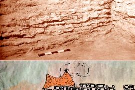
Tuşpa, which King Sarduri I established and made the capital, contains the summer pastures of the Urartian kings and long inscriptions. On the shore of Lake Van, the orderly stones of the old pier from the Urartian period are still in place. Each of the limestone blocks with maktra weighs between 4 and 18 tons. These stones were cut by the Urartians in Van-Edremit and transported here. They were piled on top of each other to form the pier wall. On the inner and outer surfaces of these stones, how the pier was built was written in cuneiform in six places; one is worn, the others can be read. This pier is truly unique, but today Lake Van has filled in and retreated 200-300 meters further.
The Horhor Inscription on the lower plain of Old Van to the northwest is the longest inscription in the castle and is located on the walls of the three-room carved structure entered from the valley at the right exit of the castle. There are also cuneiform inscriptions at the entrance of the burial chamber belonging to King Argishti. Here there are places for sacrificing to the gods, collecting blood, and piling meat.
The inscriptions written on large rocks in the sacred area of Analı Kız are seen with great splendor. This is an altar area. In the Inner Castle, the foundations of a temple related to the Urartians can be found. The purpose of the magnificent structure called Madır Burcu on the west side of the castle is not exactly known, but it is thought to be a harbor. Excavations have been carried out at Van Castle Mound to the north of the castle, and Istanbul University is excavating.
In the castle, there is the Hüsrev Pasha Complex, a work of Mimar Sinan, consisting of a caravanserai, bath, tomb, soup kitchen, fountain, and madrasa. The only intact bath in the region is the Çifte Yunak, which is a unit of this complex. The only structure still in use in Old Van today is the Kaya Çelebi Mosque. Unfortunately, the once magnificent Van Grand Mosque has been destroyed today; only its minaret has survived intact. The Red Mosque is also in ruins; only the lower part of its minaret has reached the present day, while the other sections have been destroyed. In the city, the structures that have survived to the present day include S. Dsirvanor, S. Stephan, S. Vardan, S. Neshan, the oldest church of the city, and the Twin Church known as S. Paulos and S. Petros. In addition, the Meryem Ana (S. Haç, Tiramary) Church, where a piece related to the crucifixion of Jesus was once kept, and the Vaftizci Yahya (S. Hovhannes) Church built on top of Madır Burcu have been destroyed. The foundations of the Hüsrev Pasha Caravanserai can be seen between the Kaya Çelebi and Hüsrev Pasha Mosques. The Horhor gardens to the west of the city were the gardens inside the city walls, right in front of the Pier Gate. Near the gardens are the remains of the Horhor Mosque and Madrasa that have survived to the present day. The castle and Old Van city, which Evliya Çelebi described magnificently, are now under maintenance. Excavations continue at the castle, the eastern mounds, and Old Van by Istanbul University.
They say Van’s breakfast is famous, but from what we did, I saw two differences: one is kavut, the other is murtıga, and another is Van herb cheese. Kavut is made from coarsely ground and roasted wheat. It looks like sesame paste, brown in color, neither sweet nor salty. It goes well with honey. Murtıga is a dish made with eggs, something between an omelette and pita bread, and it is said to be eaten with sweets. We ate with American music; I guess these are cultural impositions. Where are our beautiful Turkish melodies? What is there not to like about us? What are we ashamed of? Who are we looking for in ourselves?
The lake turned to a light turquoise color. After breakfast, we will head to Akdamar Island. The weather is cool. We felt cold in the evening.
Swimming in Akdamar (Ahdamar) Is Something Else
Prof. Dr. Övgün Ahmet ERCAN
[email protected]
www.ahmetercan.net
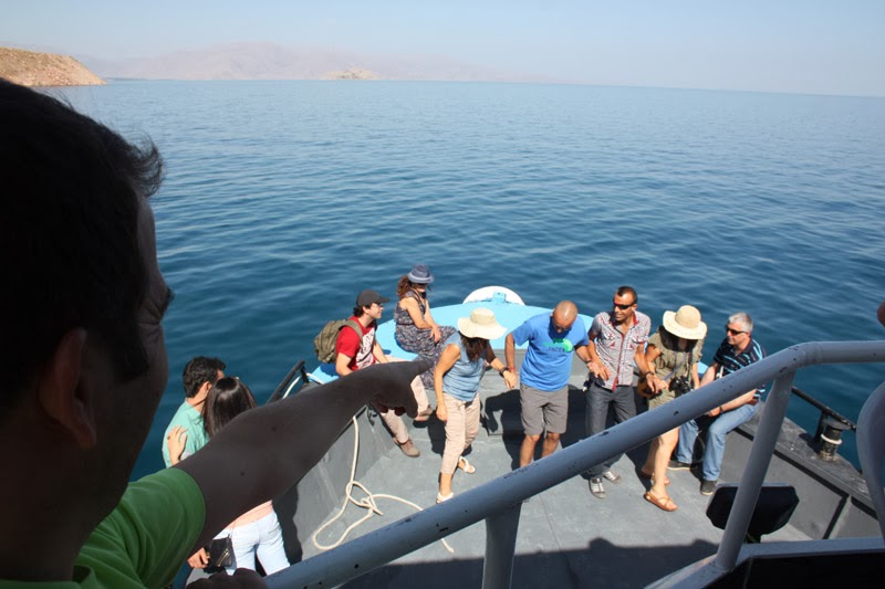
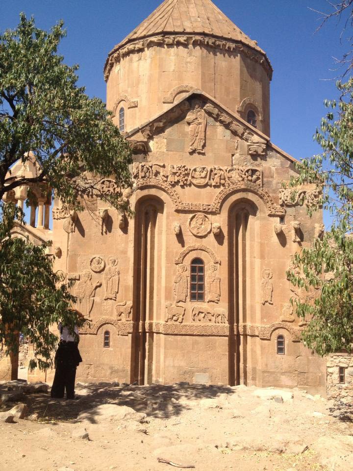
On Monday, August 26, 2013, we left Van-Edremit and came to Gevaş, 43 km away. Gevaş is a green city on the shore of Van. We boarded the waiting boat and reached Akdamar Island in about 25 minutes. Akdamar Island is not a very large island; it is about 100 acres. From a distance, it looks like a lying partridge. When we approached the pier, I was surprised to see the lake’s crystal-clear turquoise water. We got off the steps and came to the monastery on the east side of the island. The stones used to build the monastery are red-brown volcanic stones and white limestone from Edremit. The monastery and church have been taken under maintenance. Most of the plaster inside the church has fallen off; the paintings were made with root dyes. During the restoration, they were gone over again with root dyes. On the southern hill of the church is the cemetery area, and to the east is the ruined monastery area. The surroundings of the church are full of almond trees. It is clear that the soil in Van is very suitable for almond trees, but strangely, not a single one has been planted in the continental region. There used to be residences to the north of the church, but today there is not even a ruin left.
100 meters below the church, there is a toilet and a tea garden. On the hill overlooking Van, a medium-sized Turkish flag is waving. Every year on the second Sunday of September, Armenians from all over the world would come here and hold collective worship. However, their numbers are decreasing. Those coming from Armenia come for the day. For them, visiting Akdamar is like being a half-pilgrim.
To make a place a country, you definitely need to leave development works behind.
The sea is crystal clear and very beautiful. When four or five friends who brought their swimsuits jumped in, I couldn’t resist and entered Lake Van in my underwear. The water is transparent; the bottom is visible. It is also relatively warmer compared to Edremit. I cooled off so much and enjoyed it so much that I cannot describe it.
I got on the boat in my underwear; I had nothing to be ashamed of in front of anyone. I sat with Nesligül Keskin (English teacher) and Gülin Hanım (healthcare worker), and we had a very nice conversation. At one point I got up and changed my underwear. We made the wet underwear into a flag. The boat that departs every 30 minutes returned us to Gevaş with beautiful memories. We set off for Van Castle. While approaching Edremit, we saw white foam in an area of about 5 acres inside Lake Van, with all the seagulls in it. I think this must be sulfate.
Muradiye Waterfall Flowing with a Roar
Prof. Dr. Övgün Ahmet ERCAN
[email protected]
www.ahmetercan.net
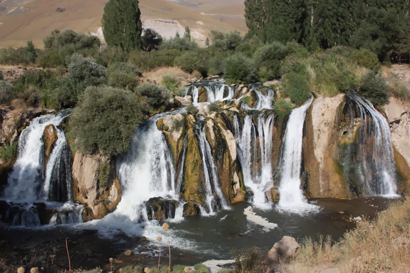
The Muradiye Waterfall is located on the Bendimahi Stream. Its location is 5 km north of Muradiye town, which is in the northeast of Lake Van. The area is covered with volcanic rocks (basalt). The Bendimahi River falls from the east, perpendicular to it, from about 15 meters high in five cascades. The river flows through a canyon about 20 meters wide toward Lake Van. There is a suspension bridge about 50 meters long over the Bendimahi River. The surroundings are orderly; we ate trout across the river, and the toilet was clean. Apart from poplars, there is no other greenery around. The mountains are covered with basalt and are bare.
200 meters northwest of the waterfall, a hydroelectric power plant is in operation, producing electricity. Foot travel has become a business here; entrance is 50 kuruş.
Along the Tendürek-Süphan Volcanoes and Aladağlar to Doğu Bayazıt
Prof. Dr. Övgün Ahmet ERCAN
[email protected]
www.ahmetercan.net
The road from Van toward Muradiye is a very nice asphalt road. After the Muradiye waterfall, the geological structure of the bare area can be observed very clearly. It is as if you are passing through an exhibition of earth and nature products. The soil consists of easily erodible units. On top of it, like a carpet, the lavas (balkılar) erupted from Mount Tendürek and Mount Süphan have covered it. Its color is dark brownish. Opposite, Mount Tendürek stands alone as a volcano on the left. After crossing the Aladağlar, we pass through the Tendürek pass and enter Ağrı territory.
Muradiye is a small district known for the Muradiye earthquake. It is located at the very tip of the northern nose of Lake Van. After leaving Muradiye, we passed Babacan, Çiçekli, Muradiye Waterfall, Ayrancılar, and then the Çaldıran district. When Çaldıran is mentioned, the great Muradiye-Çaldıran earthquake comes to mind. The area between Çaldıran and Doğu Bayazıt is like an open geological exhibition formed by two-stage volcanic lavas. To the west, the great Mount Tendürek, which emitted these eruptions, watches over us. The first eruption brought dark material, light brown. The last eruption covered it and the depressions, carrying huge volcanic rocks within it.
In Çaldıran, Esen Hoca told the history covering the periods of Murat II, Fatih, Bayazıt II, and Yavuz Sultan Selim with great entertainment, curiosity, and fluency — I had never heard such a history narration before. While passing interesting places, he gave me the microphone and had me explain the surroundings from a geological perspective.
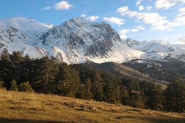
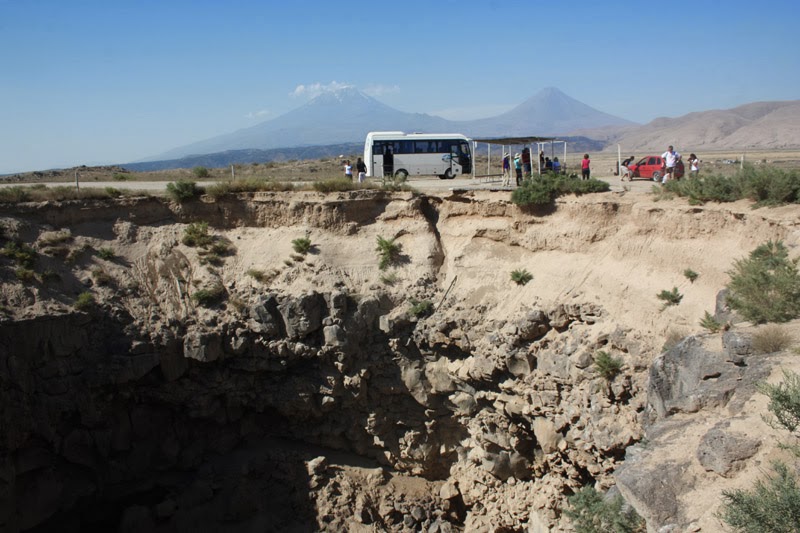
There were a few ponds and black volcanic ashes around. Occasionally, animals grazing in the treeless area. Mount Süphan was left behind. To the east (right), the Iranian border and observation points were on the hills 300-400 meters ahead of us. We started seeing the checkpoints we used for defense against the PKK frequently on the hills. There were armored vehicles and tanks inside the checkpoints in between. However, there was no tension or road checks in the environment. Peace and tranquility prevailed. At the first place we saw it, we got out of the vehicle and watched the huge upright stance of Mount Ararat with great admiration. Its summit looked as if it was cut off, and it was cloudy on top. About 2-3 km to its east, the relatively steep Lesser Mount Ararat stands close to Iran, like a child looking at its father.
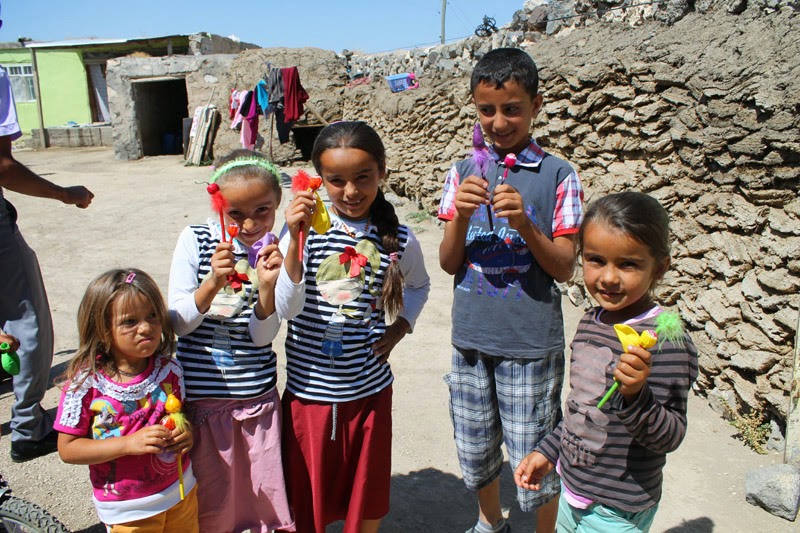
There was a village right below where we stopped. The children were shouting and waving at us. Mud-brick houses, a mosque, piled dung and grass, a few chickens. They are in complete helplessness. There is no Turkish flag waving anywhere. Two children, 7-8 years old, boys, came running. We had a nice chat with them; they were very cute. Our friends hugged them and took photos. We gave them a few coins. It seems unlikely that educated people will emerge from this village.
We left with a heavy heart.
I AM VERY HAPPY THAT I CLIMBED MOUNT ARARAT AT THE AGE OF 65
Prof. Dr. Övgün Ahmet ERCAN
[email protected]
www.ahmetercan.net
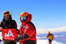
I never thought I would be able to climb Mount Ararat (Ararat) one day. At the age of 65, today I climbed Mount Ararat with 30 people under the leadership of Nuh Ararat-Yudosk guides; the date is Tuesday, August 27, 2013; 15:56.
To climb Mount Ararat, one first comes to the district of Doğu Bayazıt. The accommodation where one can stay is the 3-star SİM-ER hotel, 8 km east of the town, on the right side of the Gürbulak-Iran road; phone 0472 312-4842. Daily bed + breakfast is around 100 TL; the beds are clean. It is in greenery; I especially recommend eating the green apples in the garden.
The identities of those who will climb Ararat are sent to the gendarmerie in Doğu Bayazıt. Permission is granted. Foreigners are prohibited from taking photos. The trip leader Mehmet Çeven (from Doğu Bayazıt) handled these matters very quickly. The security forces call those who have gone up the mountain from their mobile phones and ask;
“How are you? Where are you? Is there any problem?”
This gives us citizens a sense of security.
We loaded our belongings onto the vehicles and, passing through bad roads and the village of El, we reached the departure point at 2,200 meters. From there I looked at Ararat. There were fluffy clouds on the huge mountain. After a while, I saw that all the clouds around had gathered at the summit of Ararat. Interestingly, the day was sunny and clear, but because it was very windy, it was never hot. The gathered clouds left their ice-like snow on the top of the mountain and moved away. On the northwest slope of the mountain, in the direction of Iğdır, the Takke Glacier, which never melts, extends in a long line from the volcanic crater toward Iğdır.
Meanwhile, the belongings to be taken up the mountain were loaded onto 8 horses at the departure point, and they set off. Although most of us are educated, I was surprised and criticized a few people for throwing the chocolate and cake wrappers they ate, as well as plastic water bottles, into nature. In my opinion, the guides should definitely warn those going up the mountain about environmental cleanliness and not leaving litter before starting the climb.
The head guide who will take us up the mountain is Memet Çeven (Çeven means horse), and his assistants, his nephews Erkan Çimril (intelligent) (guide), Erhan Çimril (guide), and Ercan Çimril (guard) are with us. The poşu Erhan tied on his head is in PKK colors. I hope he is not a sympathizer, I thought. The horsemen are Ahmet Çavaran, Ramazan Çavaran, Adem Aslan, and Rıdvan Saltık. They are all slim and thin as a needle. They say they climb the place we climb in 4 hours in 45 minutes. To the summit, round trip is 9 hours — hard to believe. The guides earn 100 dollars a day. The horsemen take the load from 2,200 meters, first to 2,900, then to 3,200, then to the accommodation at 4,200 meters. They wait for those who will go to the summit there, then take the loads back and leave them at 2,200 meters. For this transportation lasting 4 to 5 days, they receive 200 TL per horse. They eat and sleep with Nuh-Ararat, staying in the pitched tents. At the accommodation, the horses graze. One of the horses gave birth to a foal 3 months ago; it follows its mother, both nursing and learning transportation. The horsemen are put on a queue in Doğu Bayazıt. Whoever’s turn it is, they go up the mountain.
Mehmet Çeven gathered all of us and distributed the lunch packages. We took our backpacks; there are spare underwear inside. However, in my opinion, you should never carry weight on you when climbing a mountain. You should be quite light. I wore caterpillar-soled, studded boots on my feet. Otherwise, the ankle can twist.
“The Armenian name of Ararat is ‘Ararat’ or ‘Masis’; in the Seljuk period, it was called ‘Eğri Dağ.’ In the holy books, its name is Ararat, Kuh-i Nuh, Cebel ül Haris.”
One of the travelers in our group, Şake Yalçın Hanım, added,
“I am a Turk of Armenian descent. Ararat is sacred for Armenians. Many of them want to climb Ararat. However, it is wrongly thought that Turkey prevents it. Especially those who migrated from Lebanon to the USA or Europe know Turkey very differently. The interesting thing is that Mount Ararat is the symbol of Armenia. Mount Ararat is clearly visible from Armenia.”
Contrary to Marco Polo’s statement that Mount Ararat can never be climbed, the first ascent was achieved by Prof. Frederik Von Parat on October 9, 1829. The first solo winter climb, relying on rock cracks, was carried out on February 21, 1970, by Dr. Bozkurt Ergör, former president of the Mountaineering Federation. In the 1980s, thousands of mountaineers climbed Mount Ararat. Climbing Ararat was banned in 1990. The ban was lifted in 1998 when the Mountaineering Federation gave permission to a group of climbers.
According to the Old Testament (Torah), Mount Ararat is known as the place where Noah’s ark rested after the Great Flood. However, in the Quran, it is stated that Noah’s ark rested on “Cudi” [5]. In the 1950s, shapes resembling a ship in photographs taken from the sky were interpreted as indicating the location of Noah’s ark, but they are unfounded.
Ararat, with its height of 5,165 meters, is Turkey’s highest mountain and has two summits. The higher one is the Atatürk summit, the lower one is the İnönü summit. Up to 4,000 meters it consists of black stone (basalt), and afterward of andesite lavas. The cap glacier at the summit of the mountain is Turkey’s largest glacier. Not many people climb from there. The summit of Ararat is a volcanic mountain covered with snow that does not melt in four seasons. It is within the borders of Turkey’s Ağrı province. The mountain is 16 km west of Iran and 32 km south of Armenia. 35% of the mountain is in Iğdır province, and the remaining 65% is in Ağrı province.
“Mount Ararat is defined as a high-altitude climb. At high altitude, the pressure and oxygen ratio is much less than in the low-altitude cities where we live. Our body needs to be acclimatized to breathless conditions. In mountaineering, this is called acclimatization. If acclimatization is not achieved, climbers lose their appetite, their hands and feet feel weak, and nausea and sleepiness are observed. The Ararat climb is definitely not more difficult than the Kaçkar or Süphan Mountain climbs. However, there is a sudden steepening on Ararat that is not seen on other mountains. There is no climbing path that rises and falls like on Kaçkar Mountain, crossing valleys and rising again. You climb continuously. This causes the body to face altitude with every step. Another difference of Mount Ararat is the glacier that is crossed before reaching the summit. However, we will not go to the summit. One of the most important factors affecting the Ararat climb is the constant change of the day and the sky. This change is especially variable after 4,200 meters. Our friends Aslıhan and Hatice among us reached the summit 3 days ago. In August, at this altitude, they were caught in snowfall and a strong blizzard. However, if anyone among you wants, we will only try 4,200 meters.”
“The climb to Ararat starts from the district of Doğu Bayazıt. Those who want to exit from the glacier can also start from Iğdır in the north. We will do Ararat from the familiar and frequently used southern face. The northern routes from the Iğdır direction are more conscious glacier climbs. However, going over the glacier is much more difficult.”
“Friends, the rule of mountain climbing is that everyone lines up one after another. Never throw litter on the mountain. In the walking column, the guide has undisputed authority. Whatever he says, it is obeyed. No scattering. I will go in front, but Erhan and Erkan will be in between, and Esen Hoca will gather those coming from behind at the very back. Do not compete with yourself or others; use your energy economically. Do not make your friends wait while taking photos.”
The walk started with great enthusiasm. At first, I was in the middle with Nesligül Hanım. Nesligül Hanım is a polite woman. She is of Georgian origin from Artvin, a very delicate person both physically and spiritually. We walked talking about Turkish and English. Later, I overtook the others and followed behind the lead guide Mehmet, who was not leaving the side of Yalçın Bey from Erzincan Eğin (Kemaliye), the logistics officer. Behind me came Gülin Hanım from Kars-Kağızman, the healthcare worker, with two poles.
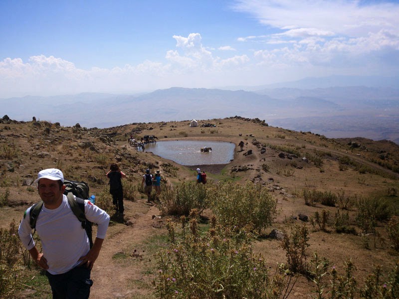
“Ercan Hoca, we do this work between June and September. Snow covers above 4,000 meters in September, above 3,000 meters in October, and then all the way to the plain of Doğu Bayazıt. Snow below retreats in March, at 3,000 meters from May. On Ararat, it retreats above 4,000 meters in June. As the snow melts, rushing waters from these mountains fill the streams and descend to the plain. The people of Doğu Bayazıt, burning in the heat of the plain, come to the plateaus here. They use the melting snow waters that fill the small streams. They make these pools for the animals to drink. Here they make yogurt and cheese, shear wool. After the second week of August, when the streams dry up, they return to the winter quarters (Doğu Bayazıt). My childhood passed in these mountains. We are mountain people. We know Ararat inch by inch.”
“How many times have you reached the summit?”
“The summit of Ararat is 5,165 meters. I have climbed it 319 times, my father more than 500 times.”
“Wow.”
“I have also climbed the Demavent summit in the Zagros Mountains in Iran five or six times. Its height is 5,650 meters. I have also climbed Mount Kilimanjaro in Africa (6,000 m).”
“That is why you are as fit as a needle and free. Well done to you.”
“Thank you, Hoca.”
We continue walking and climbing on goat paths among the rocks. Burned andesite rocks with white feldspar eyes, and on top of them, in masses, brown porous, bubbly basalt layers. In some places, dark-colored tuff stones, old, hollowed andesite, and fresh solid andesite can be seen.
Nilüfer Dündar Hanım, interested in geology,
“Look at these andesites! They can especially contain gold, silver, sulfurous copper, lead, and iron ores.”
“Look, the top of Mount Ararat looks as if it has been cut crooked. Its mouth faces west. There is a glacier that never melts on the western-facing summit.”
“Hoca, we also climb on that glacier. About 10,000 people come every year to climb Ararat. In winter, we do the climb with skis. There is badger fur under the climbing skis. When you step, it does not slide back. We go up to the summit with skis and then descend. Most accidents happen during descent. Because the person gets excited thinking ‘I made it’ and wants to descend quickly with enthusiasm, then stumbles. I am also a rescuer; I am a member of DAKUT.”
She continues,
“However, altitude affects some people negatively. Some experience ‘altitude drunkenness’ due to lack of oxygen. They lose consciousness and start doing things they shouldn’t. Sometimes they become aggressive, sometimes they cry continuously. That is why we prefer staged ascent. We climb by camping at various altitude stages. This is the right way. To let the body get used to it, we first go up to 4,200 and then return to 3,800.”
“Isn’t it difficult?”
“There is a rule for climbing mountains. It must be followed. I have taken a 75-year-old, two blind people, someone who had his foot amputated, a lame person, and someone who had just had bypass surgery up the mountain. Everyone can climb, but with an experienced mountaineer. No games, no races, slowly and patiently.”
Meanwhile, I also inform my friends,
“Look, there are lava channels that have flowed like rivers in the bosom of the mountain, filling the valleys. Look, the reddish crack seen in the last eruption flow also contains hematite, which is iron ore.”
We walk bravely among the stones and dusty soil, among camel thorn, thistles, bear’s ear, thyme scents, and wild nettles.
Meanwhile, a nettle stung Nilüfer Dinçer Hanım.
“Ouch, it hurts a lot, the nettle stung me.”
“Plants don’t sting, dogs bite. Plants sting. That is why that plant is called dalgan.”
“Never mind, I will call it nettle.”
“!!!!!”
The voices of Mehmet Çeven Bey and his nephews Erhan, Ercan, and Erkan are melodious like every Easterner. They walk and sing folk songs; they enliven the surroundings by singing their sometimes enthusiastic, sometimes painful melodies mixed in Turkish, Kurdish, and English. Occasionally we joined them too. Since Mehmet Bey’s father, Halis Çeven, was one of the first to climb Mount Ararat, German TV filmed him. Erhan portrayed his childhood.
After an hour, we started to get a little tired; my backpack, which did not exceed 4 kilos, started to feel like 15 kilos to me. The guide Mehmet Çeven Bey, noticing this,
“Hoca, leave the backpack with you, but give the contents to Erhan’s saddle.”
“Won’t I be a burden to you?”
“How could that be, Hoca! This is our duty.”
I gave the apples and the extra water bottle to Erhan. We rested for about 15 minutes and took photos. While setting off again, the guide Mehmet said to Erhan,
“Erhan, you take Ercan Hoca and Özden Özen Hanım. Go slowly ahead; we will catch up with you. Don’t go too fast.”
We started walking at a slower pace, but I can say that walking slowly tired me.
“Erhan, where is this accommodation place at 2,900 meters?”
“Ercan Hoca, you see that hill opposite! It is behind it; it cannot be seen from here.”
Computer officer Ali Doğuyıldız Bey also joined behind us. Every time we stopped, I threw myself on the grass and stones. It felt like a feather bed to me.
Those coming from behind overtook us. However, my heart was beating so hard that I could not compete with anyone. Because as we climbed higher, the oxygen decreased.
Finally, the 2,900-meter accommodation area was seen. A few tents, free-grazing horses. Just 500 meters ahead, behind that rocky outcrop, but I had no strength left in my hands or feet. I lay down on the rocks; the sun was burning me fiercely, but I didn’t care. Özden Hanım also lay down and stretched on the grassy, stony area; Ali Bey sat on a rock, playing with his phone — after all, he is young.
When we reached the accommodation area three hours later, our friends welcomed us with applause. Fatma Hanım (construction officer) immediately poured a piping hot tea.
“Oh, it went so nicely in the cool air.”
Ali Dinçler Bey,
“Hoca, you are soaked. Change your clothes immediately.”
My tent was set up, orange. Inside, I spread the mat and bed that Jale gave me.
The tents created a riot of colors. Everyone was very happy. Erhan distributed hats and shirts to everyone as a souvenir of “I made it.” The horses were scattered among the rocks.
Serpil Şahin and some others rode horses.
Behind us, the huge, snow-capped summit of Ararat embraced us with all its majesty. Meanwhile, a few people were returning from the summit. The open sky suddenly filled with clouds. Thunder began. How much I love the sound of thunder.
“Look! It is going to rain. Snow is falling on the summit. Ararat’s behavior is unpredictable. While the sky is completely clear, clouds suddenly gather, darken, rain falls, hail falls, snow falls. You must always be alert.”
Cattle, sheep, and goat herds began to appear from the upper hills. The shepherds’ songs reach the camp. How beautiful it is in this silence.
There is no electricity where we are. We turned on the gas lamp. We see inside the tents with hand and head lamps. It is as if we are in an eagle’s nest; a bath was built on the hill overlooking Doğu Bayazıt, and a tent toilet on the Ararat side. There is water; the horses carried it from below.
As the sun set behind the mountains behind Doğu Bayazıt, the most beautiful images of life appeared. The shepherd star sparkled above the mountain range that had taken on shades of blue. The redness at the place where the sun set is worth a lifetime. The redness turned to coffee, then to dark; the stars appeared, shining brightly. The shepherd star is right opposite in the west. How sharply it spreads light. The moon will rise from the east, but we must wait until 01:00. The most beautiful thing about Ararat’s darkness is that you see all the stars, the Milky Way, and near space clearly.
Tuğrul Yiğiter Bey pointed with his hand,
“Look, that is the Little Bear constellation.”
“I want to see the Milky Way.”
“That must be the Orion arm.”
Little Eda, curled up on the stool, is reading her book illuminated by her lamp.
We started getting to know the participants one by one. Hanife Çakmaklı Hanım was born in Milas. With her, we chatted in our Aydın dialect: “our girl,” “our boy.”
I don’t know how the conversation started, but the topic turned to the similarity between “Urfa Göbekli Tepe” and turning around the Kaaba 7 times in Mecca. My critical speech tensed Pervin Birsen Hanım. However, I liked that lawyer Özden Hanım stated she agreed with what I said about faith, and architect Müberra Taştekin examined it using her mind. Although lawyer Sezer Bilen Hanım opposed everything by saying “I do not agree,” without developing any thought, it created monotony. This behavior must have tensed Nilüfer Hanım too, because she couldn’t stay silent:
“Brother, you are always so negative. You always see the empty side of the glass.”
“Me?”
“Yes, you.”
Gülin İlbars, born and raised in Kars-Kağızman, is a girl who looks as honest as she is. She speaks Turkish with an Eastern accent. She knows melodies and songs, and is also participatory, like Müberra, Nilüfer, Nesligül Hanımlar, and Tuğrul Yiğiter (whose grandfather was a composer), Yalçın Önen, and İlhan Tellioğlu. İlhan Bey is also a whistler.
A cold breeze is blowing. I changed my short pants to long ones. The friends made a circle and opened a discussion on “divorce” around it; it turns out İlhan Bey was gathering information for himself; he will write a book. İlhan Bey is quite enterprising, has a sharp memory, and is a retired major. Nowadays he does real estate in Okmeydanı. There is no job he cannot handle. He is free and good-hearted. If only he didn’t whistle continuously on the bus. However, he is a perfect travel companion with his wife Hülya Tellioğlu. Yalçın Bey has recently divorced and has severed all his relationships. Now he knows how to make all kinds of pasta. He is the logistics manager at Mercedes.
Esen Hoca came,
“Leave this boring topic; let’s sing heart-opening Turkish art music songs.”
Erhan and Mehmet Bey from Topçatan village of Doğu Bayazıt sang Turkish and Kurdish melodies reflecting the Dengbej culture. Both have very beautiful voices. They asked me for “Çökertme” and then “Yörük Ali”; I sang them.
The two madly in love members of the group, Can Arbak and Esra Tunçbilek from İTÜ, were sitting hand in hand, far away on the rocks, enjoying the taste of love. This pair of doves did not join the group at all.
Then Mustafa Esen Hoca came and told about “Çerkez Ethem” like a legend with his deep knowledge. How beautifully he tells it.
At 23:30 we withdrew to the tents. I froze, my God, I froze. The cold penetrated to my bones.
Around 01:30 at night I got up. The half moon was illuminating the surroundings. Ah, when I looked at Ararat, there were lights moving at 4,200 meters in the darkness. I watched them for a long time; it turns out they had started walking to the summit; they would arrive around 07:30.
I urinated next to the tent. The sound of the trickle sounded like music.
I lay down again.
“This cannot go on like this. Tomorrow I will definitely return.”
While the day was dawning, I had slept for 1.5-2 hours. It turns out no one could sleep.
“Mehmet Bey, is there PKK here?”
“There is on every mountain. On Ararat, Süphan, Tendürek. But there is peace now. I prevented my two brothers from going up the mountain by giving them jobs. Look at this plain of Doğu Bayazıt; every kind of fruit grows here: peach, apple, plum. But the people are lazy and don’t plant them. They go to Iran for smuggling and bring cigarettes. They earn 50 TL a day and sit in the coffeehouse from morning to evening with it. But for the last 10 years, the health and agricultural services provided by the state have been extraordinary. I hope Doğu Bayazıt will change from now on. 10 years ago there was not a single university student here; now there are 400-500. Our doctors and officials are all local.”
15 people from among us set off to climb to 3,200 meters. I stayed at the accommodation. Tomorrow’s descent is said to be very tiring.
At the camp, there is our brother Burhan, a large-built man who provides all the conditions, security, food, and order of the camp. Burhan would give his life for the guests. He is about 1.90 tall, around 40 years old, thin as a needle, like a branch, fatherly, speaking with seriousness and delicacy. His skin, tanned by the sun, is sweaty. A poşu is tied on his zero-shaved head; he is very strong and never tires. He gets up at 04:00 before sunrise and arranges everything.
“Last night I was very cold, Burhan. I don’t remember ever being this cold in my life; the cold entered my bones.”
“Hoca, let me give you my sleeping bag; you give me yours. Sleep comfortably. It may smell a bit of sweat, though — forgive me.”
“How can that be, Burhan? What will you do?”
“Hoca, we are mountain people; we are used to the cold.”
He went and brought it, opened it, and spread it on top of my tent to air it out.
“Hoca, we have become identified with this Mount Ararat. Even if nothing happens, I come once a year and stay on the mountain for 5 days. This mountain is ours, our life, our blood.”
“Is there a lot of work?”
“I also do guiding myself; I am not just a cook. Work here ends around September 15 or October. I take my axe in hand and go to work on construction sites in Marmaris and Bodrum. If I stayed here, I would work but there is no money. There I earn around 2,500 TL a month and see money in my hand. I have four children at home; all boys. The oldest is 12. My wife didn’t give me a girl. If I could get 5-10 thousand TL in my hand, I would take another girl so she would give me a daughter.”
“Hey, how can there be two wives?”
“Around here, if you have money, there can be three or four, Hoca. Give the money and I will get you as many as you want. A girl child is different, Hoca. When you get old, they take care of their parents. A girl is necessary.”
Retired Major İlhan Bey joined in:
“The East is like that, Ercan Hoca! I was doing my lieutenant duty in Mardin; my salary was 1,500 TL. My wife was far away and I was bored. The village headman suggested: look, there are 4 girls here; give the money and take the one you want.”
“How much for that blonde?”
“She is 600, the one next to her is 500 TL.”
“I don’t have 600 in cash. Can it be in installments?”
“Three installments are possible.”
“Well, what will happen when my duty ends?”
“Give her 200-300 TL and send her back home.”
Although these are realities of Turkey, I was still surprised.
Every local person I talked to here has no fewer than 9 siblings. The East produces children like an incubator.
“How does time pass for you here, Burhan?”
“Well, Hoca, someone reported us as PKK. We had nothing like that. I fled to the mountain and didn’t come for 5 months. Then I surrendered to the gendarmerie in Erzurum and was saved. We don’t do dirty tricks. I have done military service for this state. I am Turkish of Kurdish origin. This homeland and this flag are our flag too.”
The bloody-eyed, determined Burhan’s words pained my heart, and I wanted to get up and hug him; we are all brothers.
“Well done to you, Burhan; this suits you.”
“When I was in Marmaris, they gave my son a stone and made him throw it at the police. This is our problem too. When we go outside for bread money, there is no one to look after the children. I came and gave him a lesson.”
“You are a man of Mount Ararat, Burhan. If you don’t come, Ararat will miss you.”
“Yes, by God, it is our life.”
Those who went to 3,200 m, 4,000 m, and 4,200 m returned happily, with some delays. The 4,200 group consisted of Yalçın Önen (logistics), Ali Doğuyıldız (computer officer), Nesligül Keskin (English teacher), Fatma Konca (construction), Aslıhan Yılmaz, Hatice Kaymakçı, İTÜ lecturer Bora Döken, Serpil Şahin, and Eda Ünsal (4,000 m).
“The accommodation at 4,200 was very crowded. They said stay here tonight and let’s go to the summit tomorrow. We would have stayed, but one more day was needed. However, we will come again.”
Our youngest, Eda (14-15), climbed to 4,000 meters. She says she will come again. Now she cannot break away from Ararat. Her mother Fatma Hanım is from Divriği, fit as a needle, and has climbed the Kaçkars. When she was 2 years old, her mother and father came to Turkey from Kırcaali, Bulgaria, taking only their suitcases — a strong Turkish woman, and also very affectionate and cultured. Her close friend Ali Dinçler Bey is a former accountant; he is also from Boğaziçi and was a student of Tansu Çiller.
Ali Bey says:
“We would take her class just because she was a beautiful woman. However, her teaching was not very good. She always scheduled her classes for the last hours. Maybe she was working somewhere. Sometimes she didn’t even come to class.”
Hatice Kaymakçı and her friends walked on scree. The stones on the slope were very dangerous; when you stepped on them, they slid with a whoosh. I learned the word “çarşak” here; loose stones, rock fragments. In other words, slope debris that slides when stepped on. Lesser Ararat is both steeper and has more scree, so descending and ascending is difficult.
In the evening, we bought a black lamb and a white-headed kid goat with the money we collected; Erhan, Ercan, and Burhan slaughtered them. Dilek Erim, who works at İleri Publishing House, helped them while skinning the kid. While the meats were cooking on the sheet placed among the stone walls, with tezek burning underneath, I went under the pretext of stirring and ate a little liver, a little kidney, and a little meat. Brother Mehmet Çeven was both cooking and giving information.
“Hoca, we ate a few pieces; forgive us.”
“Of course.”
The meats cooked in the smoke. We ate until we were full with soup and bulgur. How greedy I am. However, the meats I ate kept me awake all night. In the evening there were again folk songs, halay dances, and a little history lesson from Esen Hoca about Selim III and Mahmud II, the Nizam-ı Cedid and Janissary revolts, my great-grandfather Mehmet Ali Pasha, the Egyptian Khedive, suppressing the Mora rebellion, public works, and marching on the Ottomans.
“Tomorrow departure at 06:00; at 06:30 the belongings will be loaded onto the horses and we will start descending. It will take about 1-2 hours. Go to bed early.”
We lay down. This evening I did not feel cold, but the stones digging into my back, the sloped ground, the cramped tent, the inability to breathe due to lack of oxygen, and the undigested meat pieces in my stomach bothered me a lot. I got up; around 02:00 the moon had made the surroundings completely bright. I urinated next to the tent.
“Shırrrr shırrrr shırrrr”
Everyone was in deep sleep; I hope no one heard.
I looked for water in the moonlight and drank until I was full. I looked at the summit; three or five lights were shining — obviously they had started the climb. I lay down again, got up. I saw that in the twilight, Burhan was working in the big tent.
“Burhan, what time is it?”
“Four, Hoca. Shall I bring tea?”
“No, thank you.”
We got up early. We gave the few coins we collected among us to Burhan to distribute to those who worked. He was very touched. He escorted us to the eagle’s nest below, we hugged, and leaving them behind, we set off. Especially on descent, knee pads are very important; they bear a lot of load. I put on the knee pads and gave all the load, including Hacer, to the horses. Leaving perhaps a kilometer between me and the whole walking group, I reached the vehicles near Eli village; there was no knee pain, but there was pain due to the pressure on my hips and thighs.
Ohhh, today at the Si-Mer accommodation there is a warm room and plenty of oxygen; opposite, Ararat looks at me with pride, as if saying,
“Well done to you.”
Here are the things to do during mountain ascent or descent; never forget them:
1. Wear a thin shirt on top,
2. Two trekking poles if you want,
3. Definitely wear knee pads,
4. Gum. But do not chew and throw it into nature.
5. A bottle of water in your back pocket,
6. Do not take a backpack unless necessary; after a while it becomes four times heavier,
7. A hat,
8. Cargo pants with many pockets,
9. Boots for rocky terrain, with wool socks inside,
10. An apple, plum, or cucumber in your pocket,
11. Do not rush; take slow steps and rest in between.
12. Never throw litter into nature.
Are the Remains of Noah’s Ark Real?
Prof. Dr. Övgün Ahmet ERCAN
[email protected]
www.ahmetercan.net
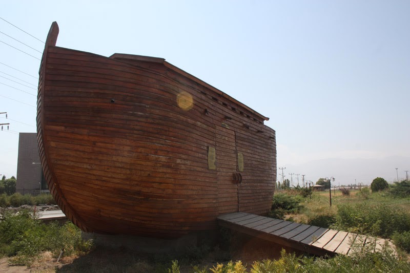
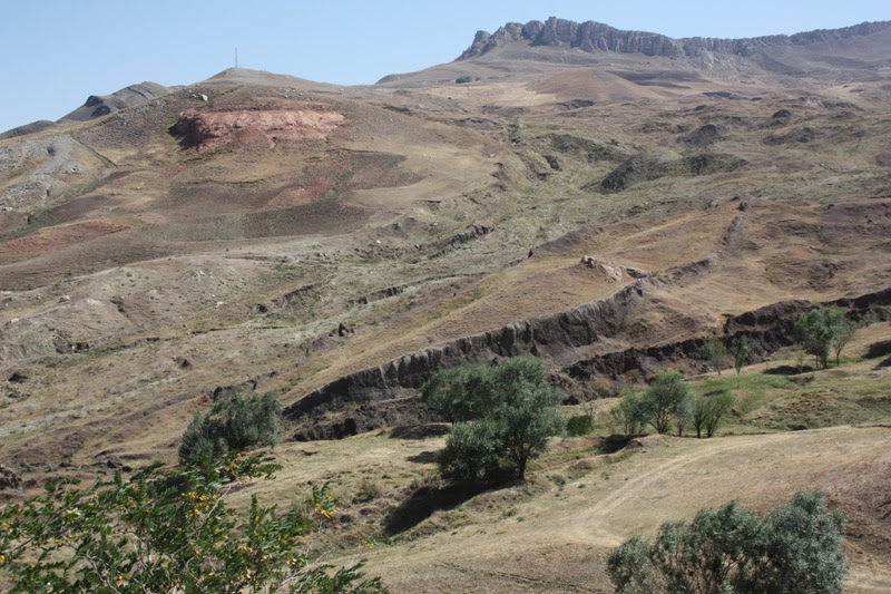
While going from Doğu Bayazıt toward the Iran-Gürbulak border, after turning right at about the 20th km and climbing the mountain for 5-6 km, one encounters a natural formation claimed to be Noah’s Ark. Here, examinations have been made using geophysical methods from space and from the ground, such as underground radar studies.
This shape inside the valley is a formation created by three faults. From space images and from the left hill before coming to the area, basalt protrusions that look like a ship can be seen. In this section, a basalt cover that erupted about 15 million years ago was later covered with volcanic ashes from subsequent eruptions. As a result of erosion by precipitation, when the upper cover in the valley was swept away, the basalt cover below was exposed.
Noah’s event must have occurred at least 1,500 years after the end of the ice age that developed 8,500 years ago, that is, around 6,000 years ago.
Since the basalt flow is older than a possible wooden ship that ran aground, a ship-shaped volcanic rock formation cannot be expected.
Moreover, since Noah took two of every creature, how did the kangaroos that came out of Noah’s Ark that ran aground in Doğu Bayazıt reach the Australian continent? Similarly, how did the creatures on Palagakos Island cross the Atlantic and Pacific Oceans and reach here from Doğu Bayazıt?
Moreover, the geophysical measurements were made only to color and make this attractive. The geophysical sections do not show the existence of a ship.
In my opinion, even if it is fabricated, travelers should go there to see this natural resemblance and develop their dreams.
What is interesting there is to clearly see Mount Ararat and Lesser Ararat, the third volcano and its layered flows, and to observe the colorful colors of the volcanic ash hills.
The plain extending toward Doğu Bayazıt and Bezirgan is actually formed by basalt and andesite fillings poured from the old eruptions of the volcanoes. It has been going on for millions of years.
Meteor Crater and Border Checkpoint
Prof. Dr. Övgün Ahmet ERCAN
[email protected]
www.ahmetercan.net
At the easternmost point of Anatolia, on the Iran-Gürbulak border, 25 km from Doğu Bayazıt, the steep and rugged mountain is Lesser Ararat. The elevations forming the gray-colored lava hills to the east of Lesser Ararat are Iran. On the Iranian border, Turkish checkpoints are frequently located. Retired Major İlhan Bey went, got permission, and came; we went down to the checkpoint. At the checkpoint, the positions are not against Iran but against Turkish territory. I guess it must be for the PKK. In the checkpoint structure, there is an observation tower, a tank, and a scorpion vehicle. In addition, there are two machine guns on the tower and about 30 brave soldiers. Smuggling is a very prominent business here. When we visited the checkpoint, two second lieutenants welcomed us. One was from the Aegean, blond, a food engineer; the other was a 1.90 tall former basketball player from Düzce, thin as a needle. Every place where there is a checkpoint is green. We sat in the shade. They offered tea and water at the checkpoint.
“You are in a good place.”
“It is not as it seems, Hoca. Three weeks ago, 12 PKK members attacked the northern checkpoint; we took them down. Moreover, there was information leaked about this attack.”
“The other side of that opposite hill is Bazergan, Iran’s. The border here is very variable, not straight. That is why it is difficult. In the middle, look, where there is that redness is the free zone. On some days it opens and shopping takes place.”
Continuous guard duty is kept along the border, and soldiers constantly observe and lie in the positions. They are all brave, the budding flowers of my country. Atatürk’s words are everywhere.
“That city opposite is Iran’s Bazergan city. Cigarette and fuel smuggling happens from there. However, we do not shoot the smugglers. We arrest them and hand them over to the security forces; they are tried. The main source of income for Doğu Bayazıt is smuggling.”
When we listened to the loud oaths of the two young men protecting the border, some of us were moved to tears.
We said goodbye.
The meteor crater is 300 meters south of the checkpoint, right on the border. On the plain, inside the basalt plain, it is a hole about 40 meters deep and about 30 meters in diameter. Its shape is a perfect circle. Thick, bright basalt surfaces can be seen where the meteorite pierced. The event probably occurred in the Holocene period, about 100,000 years ago. This is the first meteor crater I have seen, and I was very impressed.
The Playful İshak Pasha’s Palace and the Important City of the Past, Doğu Bayazıt
Prof. Dr. Övgün Ahmet ERCAN
[email protected]
www.ahmetercan.net
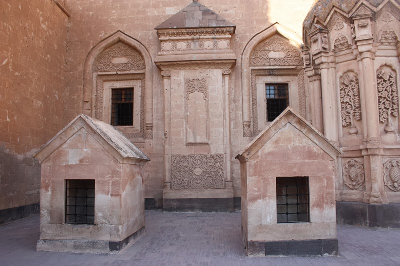
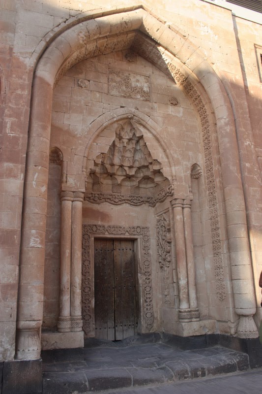
I had always been curious about İshak Pasha Palace! They used to say, “Why would a man build a palace in such a desolate place?” But when I saw it, I understood that it was not so. İshak Pasha was a sanjak bey appointed by the Ottomans to Bayazıt in 1776. İshak Pasha served as sanjak bey in Bayazıt between 1776 and 1798. İshak Pasha surrounded the hill to the east of the city, which stands like a nose, like an eagle’s nest, with white, black, and red carved volcanic ash stone and had the İshak Pasha Mosque, Palace, Bath, Complex madrasa, and other sections built inside by famous architects brought from various places in the world.
İshak Pasha built the palace right in the middle of the old settlement of Old Bayazıt, which looks down on the plain from a high place like an eagle’s nest. The old city has been a mound since the Urartian period. The right and left of the palace are cliffs; the palace is connected to the mainland only from the entrance gate, just like Van Castle. The rest is a protected hill provided by the cliffs.
Today, the palace has been almost rebuilt through restoration. Everyone may think of İshak Pasha as a victorious pasha and a respectable person. However, the situation is not quite like that. İshak Pasha was a cunning, knowledgeable, and quite playful person. He was the administrator of Bayazıt on behalf of the Ottomans.
He went so far that every young girl would sleep with him and enter the bridal chamber with him before getting married. İshak Pasha would check, “Is the girl ready for marriage? Or not?” My God. Just like the old Scottish king did.
There are those who know and see this, but they keep their mouths shut out of fear. Finally, the great man of the place, Êhmed-i Gani, could not stand it and gently warned İshak Pasha. One day he boiled nine eggs. Then he dyed them in different colors and brought them to İshak Pasha.
“My Pasha, eat this red egg and see!”
İshak Pasha peeled the shell and ate it.
“Come on, now eat this green egg.”
He peeled and ate that too. After İshak Pasha peeled and ate a few more, Gani asked,
“Are the tastes of the eggs you peeled and ate different?”
“No. The same.”
“İshak Pasha, women are like that too. The taste of the women you peel and eat is the same. Therefore, there is no meaning in tasting all kinds of women.”
This story is told like this.
I do not know what İshak Pasha did after that. However, today everyone is a bit like İshak Pasha, running from one egg to another.
The guide we hired to show us İshak Pasha Palace was truly a character. I wish he had read a little book or document. When he started speaking with,
“According to what I heard from my mother…”
I separated and toured the palace on my own, reading the information placed everywhere. The palace’s mosque, guesthouse, storerooms, harem rooms, baths, kitchens, toilets, and courtyards are extraordinarily beautiful. The entrance doors and walls are covered with floral decorations. It must definitely be seen.
This must be the best place to watch the sunset.
Êhmed-i Gani is the most famous great person known in Bayazıt. They love him very much; moreover, his handsome depiction is hung here and there. The tomb a little further from the palace is also a pilgrimage site.
Doğu Bayazıt is rich in natural beauties and historical structures. Mount Ararat, Meteor Crater, Ice Cave, Noah’s Ark, Old Bayazıt Castle, İshak Pasha Palace, Old Bayazıt Mosque, and the temple and palace remains built between 815-906 BC by Urartian kings Ispuni and his son Menua on Giriktepe are unique places that must be seen. In Old Bayazıt, Êhmed-i Xani and Halife Yusuf in Seslitaş village are religious saints, and their tombs are frequently visited.
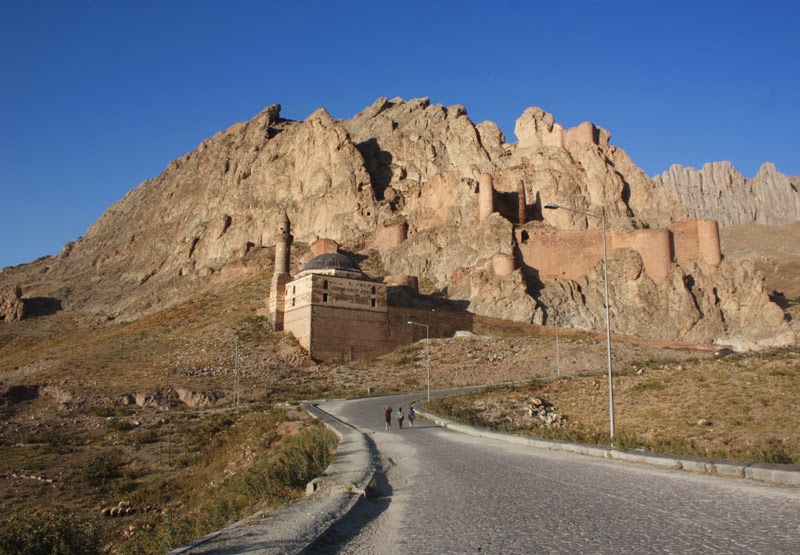
Bayazıt Mound. Doğu Bayazıt is a district of 100,000 people formed in two sections. Old Bayazıt is a city like an eagle’s nest, established right next to the main fault line consisting of five mirrors side by side, as if fingers and the palm of the hand are visible, on the slopes of the mountain to the east. How they built castles and houses on those hills is astonishing! I wonder if you have ever seen the small houses that mason bees make on walls and rocks? Or a swallow’s nest on the exact corner of a house, as if it is about to fall? Or the Simena Meryemana Monastery built on the steep rock face in Trabzon Maçka? Just like them. By the Urartians, on the steep slopes of the steep mountain, walls, ramparts, castle towers, and houses were attached as if nailed or glued. I do not know where they got the water from. The houses from the Seljuk or Ottoman periods go all the way down to the plain below. Now there are ruins of the houses from the old period. Instead, the villagers have built poorly piled stone houses in irregular shapes. Piles of greenery. The grazing animals, sheep, and goats outside are returning to their pens.
With the Russians coming here in the 1878 93 War, New Bayazıt district was established on the plain in the middle. To the north, the lofty Mount Ararat stands upright; in front, a completely flat, uncultivated, fertile plain extends along the road to Iran. To the east, there is a rising place (büğdez), and right under Doğu Bayazıt, it forms an underground pit (çukuz). In such an underground pit, there must be a large water basin fed by the Ararat mountains. However, no one extracts it and switches to irrigated agriculture.
With the Republic, İsmet İnönü came here in 1935 and started new arrangements in the town.
New Doğu Bayazıt. To the east of Doğu Bayazıt is Iran, to the south Iran, Van, Muradiye, and Çaldıran, to the west Diyadin and Taşlıçay, to the north Tuzluca, Iğdır, and Aralık. All of the district’s lands consist of plains and volcanic flows and ash stones. Even under the plain, there is thick volcanic flow. This is the place with the thickest earth crust in Turkey, at 45 km.
Turkey’s highest mountains are in Doğu Bayazıt (Ağrı). Greater Mount Ararat (5,165 m), Lesser Mount Ararat (3,896 m), Kale Tepe (3,196 m), Arı Mountain (2,934 m), Tendürek Mountain (3,533 m), and Göller Tepe (2,643 m). The high parts and foothills of these mountains are wide plateau areas where animal husbandry and dairy products are produced. The animals graze up to 4,000 meters. The mountains are bare; you cannot find even a single tree. In the past, this region could never have been bare. Since there was such a large settlement, the soil must have been very productive. The mountains should have been forested, and the plains should have been agricultural land.
The plain of Doğu Bayazıt and its extensions, the Sarısu valley, Masun, and Sürbahan protrusions, are the plains of the district. Their surroundings are also surrounded by high mountains. Agriculture is done very limitedly here. However, the ground below is like a water boiler. Although Doğu Bayazıt is a complete water collection basin, the water is not brought to the surface and irrigated agriculture is not done. They wait in coffeehouses for the state to bring water here by canal from the Murat River. In some places, there are areas where vegetables and fruits are grown in groups. In some places, the grass of meadows mowed twice to feed the animals is stored for winter. There is no wood or firewood to burn in winter. They use the dung piled in groups from summer, in house-like structures.
Its Past. Since Doğu Bayazıt is located on the Turkey-Iran transit route on the Iranian border, it has gained commercial importance for settlement and has been a favored city area under many attacks, conquests, wars, and plunder.
The fact that Urartian burials were found in the castle in Old Doğu Bayazıt takes the first settlement back to the Urartians. The first place where Doğu Bayazıt was established is the old castle in Upper Bayazıt. Bayazıt Castle bears traces from every period. Now there are only remains. When New Bayazıt was established, the stones of the structures in the old settlement were removed and used.
Since the Urartians extended from Van to the Alagöz Mountains and from there to Gökçe Lake, Doğu Bayazıt remained under Urartian rule for a long time.
In 625 AD, the Khazar Turks coming from the north of the Black Sea to the shores of the Aras took the city.
In 250 BC, the region changed hands several times between the Persian Kingdom and the Romans. Between 150 BC and 430 AD, during the period of the Lesser Arsacids, the plain of Bayazıt was called the Gokovit Sanjak. It included the double capitals at Digor and Iğdır Castle. Later, at certain intervals, it came under the rule of the Romans, Iranians, Arabs, Georgian Bagratids, and Eastern Romans. Alparslan’s first western campaign in 1064 to Anatolia included the Kars region, the Ağrı surroundings, and Doğu Bayazıt. These regions were taken from the Eastern Romans and given to the Seljuk-dependent Ani Shahs principality between 1064 and 1200. Between 1207 and 1255, the region passed to the Sökmenids. In 1231, the city was attacked by Timur together with Eastern Anatolia. In 1239, the region came under the control of the Genghisids. In 1358, the city passed to the Jalayirids, who were heirs of the Ilkhanids.
The Mongols and their branches, the Ilkhanids and Jalayirids, used these places as pastures and summer pastures for a long time and fed their armies. Orgun Han from the Mongols built a palace in Aladağ. Since the Daryunk Castle, that is, the old Bayazıt Castle, was destroyed, Celayirli Prince Bayazıt Han, the Ani Bey, who dominated the upper Aras region, came from Ahlat and Van regions in 1374 and built a castle in place of today’s Bayazıt Castle against the army of Karakoyunlu Bey Bayram Hoca (1366-1380) who attacked the Aras side; therefore, it was called Bayazıt Castle, and the city was called “Bayazıt.”
Bayazıt later passed to the Eşinoğulları, to the Karakoyunlu between 1368 and 1382, to Timur in 1386, back to the Karakoyunlu in 1406, and was attached to the Akkoyunlu between 1469 and 1502. The Iranian Turkish state of the Safavids, who defeated the Akkoyunlu in the Şarur war, expanded their influence in the region and ruled this city for 76 years between 1502 and 1576.
Yavuz Sultan Selim passed through Bayazıt on his way to Çaldıran, Kanuni Sultan Süleyman to Tabriz, and Murat IV to Iran. Yavuz Sultan Selim camped on the north side of the Bayazıt Plain, on the Sarısu side, next to Danasazı (Şahlı Lake) on August 20, 1514, while the Ottoman army was entering Çaldıran. After the Çaldıran war, Bayazıt, which passed back to Ottoman rule, later came under Iranian pressure. On June 20, 1543, when the Ottoman army set out to the east, among the Sunni locals who brought the castle key to Grand Vizier İbrahim Pasha, who was camping in Bingöl, there were also people from Bayazıt. During the period of Kanuni Sultan Süleyman, Bayazıt together with Eleşkirt was taken by the Sanjak Beys of the Van Beylerbeylik in 1578 and attached to Van as a sanjak. Bayazıt was one of the 14 sanjak centers attached to the Van Beylerbeylik. After 1744, the Bısyan, Sıpkan, and Zilan tribes and clans led by Kara-Behlül Bey from the Silvan (Farkin) region settled here.
Kara-Behlül from Silvan and his descendants became sanjak beys in Bayazıt through the “Ocaklık” way. They dispersed in the attack of Afshar Nadir Shah in 1744. After this dispersal, sanjak beys began to be appointed from Istanbul. The most famous of them was İshak Pasha. He is the one who built the palace and exploited this region.
In 1805, Amedee Jaurbert, sent as ambassador to Iran by Napoleon Bonaparte, was detained in the palace for months. Since Bayazıt is on the border and on the pass connecting Asia to Anatolia and these places to Europe, it has been subjected to the flow of many tribes. In the 15th–18th centuries, it came under Iranian rule, and in 1828, 1854, 1856, 1877–1878, and 1818–1814 under Russian rule, constantly changing hands.
As before, the last Iranian Qajar raids in 1821 and 1822 caused great loss of life and property in Bayazıt. The Russians first returned to Bayazıt according to the 1856 Paris Treaty. In the 1877-1878 Ottoman-Russian war, after the defeat at Alacadağ on October 25, 1877, when the Ottoman army withdrew to protect Erzurum, the Russians captured Bayazıt at the end of the same month. They removed the gold inlays in the palace and the gold covering on the dome. Although Bayazıt was left to Russia with the March 30, 1878 Istanbul-Yeşilköy Treaty, it was returned to the Ottomans with the July 13, 1878 Berlin Treaty. At the end of the 93 War in 1877-1878, while the Russians were withdrawing, they took the Armenians coming from Van and other locals with them and settled them in the newly established city to the west of Gökçe Lake, naming it Navo Bayazıt (New Bayazıt).
When the Armenians withdrew, Colonel Hüseyin Hüsni Efendi, the Alay Commander coming from Van, recaptured Bayazıt. After the Republic, Kamil Bey was appointed as the first governor. Iğdır and Tuzluca were attached to Bayazıt.
However, in 1927, when the cabinet decided to move the provincial center to Karaköse (new name Ağrı), Governor Ziya Tekeli went to Karaköse, and Karaköse District Governor Yusuf Ziya Bey was appointed to Bayazıt. In 1934, Iğdır and Tuzluca were taken from here and attached to Kars. In the same year, the district’s name was changed to Doğu Bayazıt. The name Bayazıt was abolished.
Surface Appearance. The plain embraced by rocks and volcanic ash stone hills in places is partly barren; there is a lot of erosion on the slopes and on the plain. Although there is shrubbery on the slopes of Mount Ararat, there is no wooded area or forest in the district. The town center and villages are quite poor in terms of trees. In the wide swamps at the foot of Mount Ararat, plenty of reeds grow.
Doğu Bayazıt, like Iğdır, is a climate enclave of Eastern Anatolia. Summers are hot and dry, winters are mild with little snowfall. The rainy period is spring and autumn. The soil structure and stream basin are quite suitable for vegetation and afforestation.
In the limited places of the plain, wheat, barley, fodder crops, and sugar beet are grown. The MTA found pumice ore in the district.
The town established 15 km from Greater Mount Ararat, on the Turkey-Iran transit route, is Ağrı’s most developed first district in terms of population. The main reasons for this are its location on the border, the development of business and trade as a result of its proximity to the Gürbulak customs gate, its mild climate, and the excessive population increase.
Diyadin Hot Springs
On the return from İshak Pasha Palace, the itinerary included going to the Diyadin hot springs, 65 km from Doğu Bayazıt on the Ağrı road. Although Nesligül Hanım insisted, since it was the first day we descended from Mount Ararat and because of the pain in my hip and thigh bone, I did not go. Like me, İlhan Bey, Pervin, and Hanife Hanım also did not go. Instead, we went to the Doğu Bayazıt market.
Doğu Bayazıt is a town of 100,000 people, similar to other Anatolian towns, imprisoned in reinforced concrete, a male-dominated town. There are almost no women on the roads. Even inside the coffeehouses, they are full of young people smoking cigarettes. There is no work or employment. Idle young people and small workshops. They drink tea and watch football matches on TV. I believe that it is not very difficult for the PKK to entice these empty and uneducated young people and take them to the mountain. They can even go just to experience some change.
Two armored vehicles passed one after another on the road; no one paid attention. There was no tension in the environment either.
There is a sweets shop where the pharmacy is. It makes ring-shaped fried sweets. The one with pistachios is 1 TL, the plain one is only 0.5 TL. I am surprised how it can be so cheap.
I said let me buy ice cream. He put three scoops.
“What milk do you make it with?”
“Mixed goat and cow. If it is pure goat, it smells, brother.”
“How much for three scoops?”
“1.5 TL”
“Can there be ice cream for 1.5 TL?”
“What can we do, brother, the cost is high.”
I was surprised. Actually, I wanted to say it was cheap. Right opposite, in the coffeehouse, four of us watched football on Lig TV. We drank one coffee, one linden tea, and six teas; only five liras in total.
We were surprised.
It is said that one can live here with 500 TL a month. There is no livelihood problem in Doğu Bayazıt. There are no workers either. Life depends on smuggling. Most people in the town speak Turkish.
Mehmet Çeven took us and bought two melons. While İlhan Bey and the others who came from the hot springs were waiting, they drank with rakı. They came from the hot springs around 24:00. The hot spring was quite neglected and hot. Most were not happy.
They sat on the balcony until 04:00 and continued nice conversations. While we were sleeping soundly in clean beds.
Tomorrow we will head to Iğdır.
Iğdır; Oghuz Homeland – Martyrs Monument
Prof. Dr. Övgün Ahmet ERCAN
[email protected]
www.ahmetercan.net
When entering Iğdır, the first thing that greets you is the Martyrs Monument consisting of 5 or 6 bayonets, commemorating those massacred by the Armenians. Upon entering, the pictures of 39 diplomats killed by the Armenians burn hearts. In addition, the visual and written information provided is very useful. In the writings, the relationship between the PKK and ASALA (Armenian massacre organization) is clearly stated. The inside of the town is green and full of fruit trees. Since we came on August 30, everywhere was filled with bright red Turkish flags. Although Iğdır is an Oghuz homeland, with the migrations received, the Kurdish Caucus (BDP) won the local elections.
It is a province located in Turkey’s Eastern Anatolia Region and at the easternmost point of Turkey. In the province, where the Mediterranean climate is dominant, even citrus fruits grow. It looks like the head and beak of a partridge facing toward Nakhchivan. It became Turkey’s 76th province on May 27, 1992, separating from Kars province. It shares borders with Azerbaijan (Nakhchivan), Iran, and Armenia. The people’s livelihood is agriculture and animal husbandry.
The Aras River forms the Turkey-Armenia border on the north and northeast of Iğdır. To its east is the border with the Nakhchivan Autonomous Republic of Azerbaijan, and to its southeast is the Turkey-Iran border. To its south are the Doğu Bayazıt and Taşlıçay districts of Ağrı province. This border roughly consists of the Karasu-Aras mountain range, which is the eastern extension of the Eastern Taurus, extending in an east-west direction. As these mountains extend eastward, they also form the border between the Upper Murat-Van Section and the Erzurum-Kars Section. To the west of Iğdır, the western section of Gaziler Stream, which joins the Aras River, forms the border with the Kağızman district of Kars province, while to the northwest is the Digor district of Kars province. Digor is a small but charming district in a depression. The road to Digor is good, but the shortcut between Digor and Ani is dirt.
Around Tuzluca, basalt and brown soils show wide distribution. According to our studies in 1982, the basalt layer thickness in this region reaches 3 to 4 km. In the Iğdır Plain, there are sedimentary soils, but in the Eastern Iğdır Plain and Dil Plain, salty soils are dominant.
Iğdır’s climate is like the Mediterranean region. Therefore, there is plenty of greenery, and its apricots are very famous. Due to its sheltered location, it is one of the regions in our country that receives the least rainfall. Especially because it has adapted to a semi-arid climate, its vegetation is the steppe, which is the symbolic vegetation of Eastern Anatolia. Unfortunately, although it is suitable, it is one of the poorest regions of our country in terms of forests.
The reason it is poor in forest cover is that its soils have been eroded and carried away. These soils, which have a high lime content, have excessive alkalinity. Therefore, salt-tolerant plants are generally seen on the plain.
When Kazım Karabekir set foot in Iğdır on May 18, 1920, there were about 400 houses in the town. Today’s population is around 75,000.
Its construction, like other Anatolian towns, is neglected, plain, and identityless reinforced concrete. When viewed from the town, the lofty Mount Ararat is visible from Iğdır. In short, the south of Ararat is Doğu Bayazıt, and the north is Iğdır.
Tuzluca Salt Mountain and Its Cave, Operation Excavations
Prof. Dr. Övgün Ahmet ERCAN
[email protected]
www.ahmetercan.net
Salt is generally divided into rock salt and sea salt. The healthy one among them is rock salt. Aluminum is added to sea salt so that it does not get wet, which causes dementia. In the Roman period, soldiers were asked whether they wanted to receive their salary as salt or as money. Salt was that valuable. In that period, salt wars were even fought between countries.
Tuzluca salt hill is a natural wonder that must be seen. The salt operation, as a closed operation, is clearly visible with huge cavities opened into the mountain on the right while going toward the Kars road. This rock salt mountain is currently operated, broken into separate grain sizes, and ground for use. We entered the excavations and caves by bus. There are intersection points in all directions reaching 500 m². The salt is transparent, white or light grayish, in thin-layered forms close to horizontal. The widths of the operation excavations are 40, their heights 20-25 meters, and their lengths 500 to 1,500 meters. They do the operation by exploding dynamite and with crushers and grinders. In addition, in a few places, the finely ground salt is bagged and offered for sale by crushers and grinders.
This salt mountain has been measured with geophysical methods; gravity and electrical measurements; its dimensions and masses have been found, and the total reserve is known.
Salt mountains are of sedimentary origin and form by the concentration of salt at 4 to 6 km depth. Since the average density of the earth is 2.54 gr/cm³ and salt is 1 gr/cm³, salt begins to rise from the depths to the surface. While rising, it carries the hydrocarbons (petroleum and natural gas) formed in the depths by attaching them to the wings of the mountain and transports them to places close to the surface. After geophysical research, petroleum is extracted by drilling into the wings of the mountain.
In my opinion, Iğdır will be a rich petroleum area in the future.
For me, one of the brightest stops of the YUDOSK trip was the Tuzluca Salt Mountain and its operation. It is a place that every person in Turkey should see. Do not miss it as long as you live.
Armenian Border. The village of Halıkışla in the Kars-Digor district is our stop on the shore of the Aras River. We stopped at Acar Facilities in Halıkışla village for a meal. The Aras River flows between us and Armenia. The village on the shore of the Aras Stream is ours; 50 meters beyond is Armenia. The observation points on the opposite hill can see us even while we are eating. The colors of the observation points are blue, maroon, and orange — the colors of the Armenian flag. The Armenian side is rural; the Turkish side is full of greenery, apple and apricot orchards.
Ani; The Old Capital of Armenia, the First City Where the Seljuks Stepped into Anatolia
Prof. Dr. Övgün Ahmet ERCAN
[email protected]
www.ahmetercan.net
“Armenian” means “mountaineer.” The city of Ani was also the capital of the Armenians. Ani was the gateway for the Seljuks to enter Anatolia. After an earthquake, the collapse of the Ani walls made it easier for the Turkmens to capture the city.
The city of Ani was built on a plateau surrounded on all sides by the canyons opened by the Arpaçay. It is a very protected settlement with only one side without a canyon. They protected the city by building high city walls on the side without a canyon. Entrance to the city is only from this direction. Therefore, it is an extraordinarily secure settlement area. Since the depth of the canyons reaches about 50-70 meters, there is no possibility of attack from the canyons. However, there are remains of a bridge in the east of the city that connects Ani with Armenian territory over the Arpaçay. Probably, the connection arch of this bridge was destroyed in the recent past for security reasons.
In addition, on the west slope of the small stream canyon to the west of the city, the number of cave houses carved into the volcanic ash stones in the early ages (polished stone) is quite high. Similar cave houses are also seen on the Turkish shores of the Arpaçay at the entrance of the city’s plateau.
We had come to Ani with Neşe in 2001. It seemed that in that period, more structures were standing in the city. Because a large amount of stones were taken from the structures and walls in the city and transported to other places, the city was greatly damaged. The opinion of İlhan Tellioğlu, who was the major responsible for this region in 1987, is the same.
Beyond the Arpaçay, which flows from the east of the city, is Armenia. The Arpaçay is a madly flowing water. The canyon it forms by opening the basalt cover goes for tens of kilometers. On the other side, there are Armenian observation towers and an operating red-stone quarry. The cut stones used in Ani are basalt, volcanic gravel (agglomerate), and volcanic ash stones, and their colors vary as brown, black, and yellowish honey color. Flat cut stones were used on the roofs of the structures. The churches were greatly damaged by people; the paintings were scratched or whitewashed over.
The Grand Mosque, to which the Seljuks added a minaret in 1071, looks more like an old church than a mosque. Although there are archaeological studies here, there is still a long way to go. During the Russian rule from 1878-1918, under the administration of Tsarist Russia, famous Orientalist Nikolai Marr conducted archaeological studies in Ani and also established a museum. In the later years of Turkish rule, the ruins, which remained within the forbidden zone for security reasons, were abandoned to neglect for a long time.
The third face of the city’s plateau, which is surrounded by Arpaçay canyons on two sides, was protected by strong walls built in the 10th century. The Lion Gate forms the main entrance of the city. The city wall, 8 churches, and a mosque are the important structures that still stand in Ani today.
Meryem Ana Church: The church called the Cathedral, the Meryem Ana Church, was built in 989 by the architect Trdat, who repaired the dome of Hagia Sophia in Istanbul for the second time. The structure, which strongly emphasizes vertical lines, gives an impressive sense of height.
The Dikran Honentz Church, located on the Arpaçay slope on the Armenian border, was repaired in 1215 and decorated with rich frescoes showing the Armenian church tradition. In the frescoes, scenes from the life of Saint Grigor/Krikor Lusavoriç, who brought Christianity to the Armenians, can be seen.
The Abugamir Pahlavuni Church, built in 1020, displays hexagonal or octagonal features inspired by Islamic architecture and frequently used in later Seljuk architecture. However, the frescoes inside were painted over and closed.
The Halaskâr (Amenaprgiç) Church from 1035 is a multi-section domed structure.
The Menuçihr Mosque is the oldest mosque built on Turkish soil after the Turks’ arrival. It was probably converted from an older structure and underwent changes for the second time in the 14th century.
Outside the archaeological area, on a fortified hill, there is also the church known as Zakare Mkhrgrdzeli’s Kızlar Church.
In addition, there is a small castle on the southern hill, and a church ruin on a peninsula on the Arpaçay shore on the Armenian border is also very interesting.
In Ani, the excavation and restoration works carried out in the recent period under the leadership of Prof. Beyhan Karamağaralı from Hacettepe University have concentrated on the Lion Gate and the Menuçihr Mosque. In addition, the works of Ms. Karamağaralı, who does her job sincerely, have encountered various criticisms in international archaeological circles.
The City’s Past. The name of Ani first appears in the 6th century as a protected place belonging to Armenian lords from the Gamsaragan lineage. The long struggle between the Armenian Gamsaragan family and the Armenian Bagrationi (Bagrat) family ended with the victory of the Bagratids; in 780, the Gamsaragans sold their possessions to the Bagratids and migrated to the Eastern Roman country.
Bagratid Ashot I was recognized as “King of Armenia / Shahanshah of Armen” by the Abbasid Caliph and the Eastern Roman Emperor in 885. Ashot and his sons first ruled in the city of Bagaran near Halimcan village, 8 km north of today’s Tuzluca district, then in Şirakavan in the Koyucak region of Akyaka district and in the center of Kars.
In 961, Ashot III (953-977) moved his capital to Ani and started the establishment of a large city here.
The city experienced its brightest period during the reigns of Smpat II (977-989) and his son Gagik (989-1020). It is said that the city’s population exceeded 100,000 during this period. In 1045, the Eastern Romans captured Ani and ended the Bagratid state. The defenseless and prosperity-less region could not resist Seljuk Sultan Alparslan in 1064 and passed to the Turks.
However, there is no indication that Seljuk rule was established in the city. After the Seljuks, the city and its surroundings came under the rule of the Kurdish-origin Shaddadid principality. The most important Islamic structure in Ani, the Menuçihr Mosque, was built in 1072 by the Shaddadid emir Menuçihr. This structure does not resemble a mosque except for its minaret.
Around 1190, the Georgian lord Zakare Mkhrgrdzeli established a base in Ani and created a dominion encompassing the Kars and Ahıska regions. His descendants first became subject to the Georgian kings in Tiflis, then to the Mongol Ilkhanids with the title of “atabey.” Many of the Christian structures in Ani were built or repaired during this period. Later, the city came under the rule of the Jalayirid and Karakoyunlu states, but its population was mostly Armenian.
Ani suffered heavy destruction in the 1319 earthquake and was later captured and ruined by Timur. However, until it was completely abandoned in the 1535 Ottoman-Iran war, some people continued to live in the city.
After visiting the ruins, we washed our faces with abundant spring water and drank tea for one lira each in the adjacent tea garden. Our friends bought “uğur” amulets made by the locals from harmala seeds for 5 to 10 TL.
We set off toward Kars.
Kars (Vanand); Caucasian Turkey
Prof. Dr. Övgün Ahmet ERCAN
[email protected]
www.ahmetercan.net
We came to Kars, the border province with Armenia, via Doğu Bayazıt, Iğdır-Tuzluca-Digor-Armenian Border-Ani. Kars is a developed province full of 16th-century Ottoman structures.
Russian Structures. The ones that contributed the most to the city’s architecture are the Seljuks, Ottomans, and Russians. After the 1877-1878 Ottoman-Russian War, Kars remained under Russian rule for 40 years, and the Russians started development works for the new city. They abandoned the settlement areas west of the Kars Stream, which is in Kars, and began to settle in today’s Yusufpaşa, Ortakapı, and Cumhuriyet neighborhoods. In 1890, the Russians brought Dutch city planners and made wide streets intersecting at right angles. However, as the developing city grew over the years, this feature was not paid attention to in the new streets built. On these wide streets, within forty years, single-, double-, and three-story structures were built in the Baltic architectural style from well-cut basalt stone. The structures called beautiful Russian houses today are these. They are among the features that make Kars Kars. However, Kars after 1970 is shameful.
When Kars’s development is mentioned, one thinks of the urban design made by the Russians after the 1878 war, wide sidewalks, wide roads, Russian houses, and Russian administrative buildings. The building stones used are generally basalt and volcanic ash stones. Especially in structures such as mosques or churches, colorful stones were used. On the entrance facades of Russian structures, there are columns and doors and windows decorated with relief stones; all are different from each other, each one more beautiful. Russian structures have small rooms so that they would be warm. Inside these structures, there were heating devices called peç. The structures were heated with pipes inside the walls. 101 of these structures were approved and taken under protection; most of them have been taken under maintenance today and many are in use.
Civilizations. The cultures that affected Kars are: early ages, Urartu, Armenian, Karaz, Seljuk, and Ottoman. The artifacts related to them can be seen in the Kars Museum. The clothing section in the Kars Museum also shows that ancient civilizations continue today. The dinosaur remains, cutters from the polished stone period, pots, and wheat grinding tools in the museum are interesting.
Kars Castle was built of basalt from the Saltukids and is quite well preserved. Around the castle, there is an Armenian church, Evliya Mosque, and a very beautiful two-legged bridge made of basalt built in the Ottoman period over the Kars Stream. The surroundings of the Kars Stream, the bridge, and the old Ottoman, Armenian, and Seljuk structures are being quickly restored. Today’s society of Kars is formed by Terekeme, locals, Azeris, Turkmens, and Kurds. Some of the Muslims living in Kars are Shia, some are Sunni. The majority of Azeris, together with the Turkmens living in the city, form the Shia (Ja’fari) community of the city. The very few Russian Molokans and Germans are Christian.
Foods. Kars has traditional dishes. Kars cuisine is mainly known for its dough dishes. In addition, there are many meat dishes. The main dishes can be listed as: kete (dough), bozbaş or piti (chickpea-meat), hangel (meatless mantı), head and trotter soup, haşil, goose dishes (goose in tandır and pilaf with goose meat, etc.), hörre (flour soup), ayran soup, and nezik (dough).
The dishes at Hanımeli restaurant are traditional. It is operated by an Armenian-origin woman. The other restaurant is Kamer restaurant. They cook fresh beans with olive oil, saffron, and by breaking an egg on top. They have two types of soups: ayran aşı and erişte aşı. Inside the erişte aşı there are green lentils, freshly cut erişte, small sour plums, nettles, and everik herb with erişte. The other dish is döşeme: lamb meat, mountain thyme, eggplant, pepper, tomato — no oil is added. The other dishes are revan köfte and Acem pilaf; long rice cooked with milk is the symbolic dish here. Our other group of friends under the leadership of İlhan Bey rented a carriage (rubber-wheeled horse carriage) for 150 TL and toured the train station, church, and other places, and ate the very famous goose meat in Kars; the plate is 30 TL.
As the real Kars people migrated to big cities, there was an influx from the villages to Kars. Today, the rate of real Kars people is around 20%. What is surprising is that the people of Kars speak Turkish with the Istanbul accent.
What Does Kars Mean? Kars means “applause” in Turkish. Other interpretations of the origin of Kars are as follows: The “Karaz” civilization turned into “Kars.” Kaşgarlı Mahmud mentions the word Kars as a garment made from camel or sheep wool and a beautiful fur made from the skin of the “karsak,” a steppe fox. According to one source, the name Kars comes from the “Karsak” clan of the Velentur branch of the Bulgarian Turks who came from the north of the Caucasus Mountains between 130-127 BC. The name of the region in the 9th century was Vanand. Kars served as the capital of the region from 928 to 961 AD. It is indicated that the name of the city at that time was “Ghars” or “Kars” in Armenian. It is also said that it took its name from the Georgian word “Kariskalaki,” meaning gateway city.
The land of Kars, with an average height of 1,768 meters, consists mostly of plateaus. In the region, which is fragmented in places by stream canyons, the plateaus consist of wavy plains. Important elevations in Kars province such as Allahuekber Mountains, Kısır Mountain, Akbaba Mountain, Aladağ, and a part of Aşağıdağ are within the borders of Kars center. The Kars Stream passes from the southwest of the city.
Kars forest is a steppe with very little forest. In Kars, nearly 1,250 seed plants grow naturally. 100 of these plants are rare plants that do not grow anywhere else in the world.
The City’s Past: Kars is a border city that served as the capital of the Armenian Bagratid Kingdom in the past and later of the Southwestern Caucasus Republic.
In the Kars region, the effectiveness of the Lower Paleolithic Period has been determined from the finds obtained in excavations. As seen in the museum, hand axes and large flakes from this period were found in Tombultepe. A tool was found in Borluk Valley, about 18 kilometers from Kars; on the west side of Ağzıacık Stream, a very worn tip made of basalt was found. These examples belong to the Middle Paleolithic Period. In the Upper Paleolithic Period, it has been determined that the local communities were engaged in hunting and gathering. In addition, in this period, walls and rocks decorated with mountain goats and deer were found in Camışlı Village; these are exhibited in the museum.
In the Neolithic Period, no important settlements were seen in the region. On Akçakale Island on Lake Çıldır, stone monuments and wall decorations from this period were found. Here, standing stones, dolmens, and cromlechs from that period were encountered. Dolmens unique to European culture were first seen in Kars in the east, after Edirne.
In Azat Village, in the Chalcolithic Period when copper mining began to be used, finds related to the tools and equipment made were obtained. In addition, pottery and various tools from the Bronze Age, when copper and tin ores were first mixed, were also found. In the Kars Castle neighborhood, a burnishing stone, hand mill stones, a hammer, a pierced animal figurine decorated with lines on top, a small stone figurine, handmade pottery, and large stone ruins thought to be building remains from this period were found.
Urartian Period. In the Kars region, the Urartians, who dominated the region between the 9th and 6th centuries BC, were a great principality. The name of the kingdom in Kars was Diauekhi. In that period, the people paid taxes to the king in the form of gold, silver, bronze, horses, cattle, and sheep.
In 550 BC, the Urartians came under Persian rule. Persian Emperor Darius I divided the country into 23 large and 127 small units called satrapies and ruled it. Kars was obliged to send 400 silver talents and 20,000 horses to King Darius every year. After the Persians, this region successively passed to the Arsacids, Tigranids, and Sasanians.
Islamic Rule. The Arabs first came to today’s Eastern Anatolia Region in the time of Omar in 638, but only as far as Lake Van. Kars submitted to the Arabs on its own in 646 but remained Christian until the Seljuks came to this region in 1064. With Alparslan’s Malazgirt victory, it passed to the Turks. Kars served as the capital of the Armenian-Georgian Bagrat Kingdom.
Seljuk Period. With the Divin War, Alparslan’s son Berkyaruk ruled the region, then his brother Muhammed Tapar took over the administration. Shortly after, the Saltukids entered the city of Ani but left the region to them after losing the war they fought with the Georgians. In 1164, the region passed back to the Seljuks. However, in 1174, with the attack of Georgian King Giorgi III, the region changed hands again. With the Battle of Kösedağ in 1243, the entire region came under Mongol rule. Then it passed to the Golden Horde State, the Karakoyunlu, and the Akkoyunlu.
In 1534, Kanuni Sultan Süleyman incorporated it into Ottoman territory. Kars was subjected to attacks by the Russians and Iranians many times until the 19th century. In this century, it constantly changed hands between the Russians and the Ottomans. During the 1828-1829 Ottoman-Russian War, the Russian army under the command of Ivan Paskevich captured Kars and also took 11,000 Ottoman soldiers prisoner. Shortly after, the region taken back by the Ottomans remained with the Russians from 1877-1878 until 1918. In 1918, after the Bolshevik Revolution, with the Brest-Litovsk Treaty, it was left to the Ottomans. Shortly after, the region first came under Armenian rule and then was captured by the British. The British left Kars to the Armenians and Georgians.
The people of Kars, on their own, in accordance with the Wilson Principles, established a democratic local administration called the National Islamic Council on November 5, 1918. The people in Batum, Artvin, Ahıska, Ahılkelek, Nakhchivan, and Ordubad joined this local administration in Kars and established sanjaks and districts. Thus, a local Turkish administration was established in a 36,000 km² region with Kars as its capital. This administration took the name Southwestern Caucasus Republic on January 18, 1919.
Turkish forces captured Kars with the War of Independence on October 30, 1920. With the Moscow and Kars Treaties signed in 1921, Kars reached its current borders.
Republican Period. Kars was the stronghold of the CHP, the founder of the Republic of Turkey, until the 1990s. In 1992, the districts of Ardahan and Iğdır attached to Kars were made provinces. As the people of Kars migrated to big cities, those coming from the villages and Kurds filled the city. With the Nagorno-Karabakh War between Armenia and Azerbaijan, the Kars customs gate was closed. Kars is the city with the most statues in Turkey. The Humanity Monument, whose construction began in 2006, was made as a 30-meter-high peace monument by Mehmet Aksoy on the hill next to Kars Castle. However, it was demolished by Prime Minister Erdoğan, who called it a “monstrosity.” This is a world shame against art.
It is understood from visiting the museum that Kars is culturally deep-rooted. On these lands, where Kars has been since 9000 BC, especially Caucasian folk dances, accompanied by davul-zurna, saz, balaban, tar, tulum, tütek, garmon, accordion, and clarinet, are played only here.
Production. The most important source of livelihood in Kars is agriculture and animal husbandry. In the dairy production facilities called Zavod in Russian, Kars kashar and Kars gruyère are produced. In addition, Kars Honey is famous. The region, which is quite poor in underground resources, has magnesite and asbestos deposits under a thick basalt cover.
In the city, feed, sugar, cement, brick, shoe, and dairy industries have developed. There has been a Caucasus University in Kars since 1992.
I saw Kars much improved compared to the last time I saw it in 2001. However, the Kars people we talked to on the road and in the streets are not happy with the mayor. They will never vote for him.
The driver says so:
“Actually, Kars is CHP-based. However, in local elections, we vote for the candidate, not the party. We were wrong in the last election.”
Kars means dairy products; it means cheese. As cheese, Kars kashar, Göbek Kashar, and Gruyère cheese come first. Old kashar is 15 TL, gruyère is 35 TL.
“8 kilos of milk make 1 kilo of kashar, 18 kilos of milk make 1 kilo of gruyère cheese. When you look at it this way, cheese is cheap.”
Other important productions in Kars are goose meat, Kars sausages, and honey.
CONCLUSION AND EVALUATION
To be a true individual of a homeland, it is not enough to simply be born there. One must see that land, benefit from its stones and soil, talk with fellow citizens from various regions, listen to their opinions, understand their ways of life, their worldviews, their values and traditions, internalize them, and find oneself within it. One must sing the melodies and folk songs they have developed over the years and listen to the laments that are sung. One must hold hands in halay dances and rejoice with the sound of every instrument. One must drink deeply from its crystal-clear waters, get wet in its streams and rivers, and swim and bathe in its seas and lakes. One must know its history and be able to say, “This history is my past.” One must protect the remnants of past civilizations and, by integrating with those past civilizations, produce reflections of them. One must nurture local cultures, enrich and develop the common language, and use it. One must protect its values, its land, its flag, its borders, its traditions, and its customs, and keep in mind that one may need to die for them when necessary.
Anatolia is such a unique country with its nature and culture that it is a peninsula where countless traces of civilizations, piled upon one another from the depths of the past and growing ever larger, have been carried to the present day — a land stretching like a horse’s head from east to west. To be an Anatolian and to be born in Anatolia is a great privilege. When the great Atatürk founded the Republic, he also said: “We Turks are not only those who came in 1071; we are the unique heirs of the civilizations that have lived in this country for at least ten thousand years.”
That is why, during our Northeast Anatolia trip, we needed to first look at the places we visited and ask: Who lived here? How did they live? What kind of remnants did they leave behind? We had to examine them by consulting the sources.
We achieved this purpose through the YUDOSK trip organization and the Nuh Ararat operator. Taking the opinions of Mustafa Esen Hoca, the valuable historian and trip leader on behalf of YUDOSK, on the history of the lands we are on, civilization, understanding, behavior, and politics greatly increased the quality of the trip. The greatest contribution to this was the high educational level of those who participated in the trip.
Farewell,
Prof. Dr. Övgün Ahmet ERCAN
İTÜ Geophysical Engineering Faculty Member
September 2, 2013
– Social Media And Contact Details –
►I N S T A G R A M – http://www.instagram.com/alidoguyildiz
►F A C E B O O K – https://www.facebook.com/alidoguyildiz
►B L O G – http://www.yuksektepeler.com
►C O N T A C T – [email protected]